Eich geodata
Eich (Rheinland-Pfalz) is a seat of a fourth-order administrative division; located in Germany in Europe/Berlin (GMT+2) time zone. In our database, there are 11009 cities with bigger population. Compared to other cities in Germany, 70.2% of cities are located further ↑North; 72% of cities are located further →East and 69.8% of cities have higher elevation than Eich. Note1


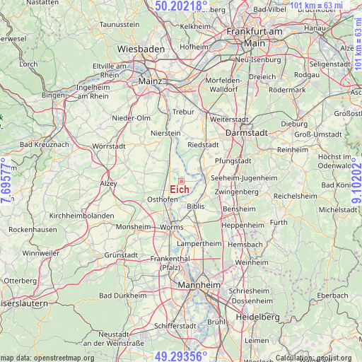
Eich GPS coordinates[2]
49° 45' 0" North, 8° 23' 56.004" East
| Map corner | latitude | longitude |
|---|---|---|
| Upper-left | 50.20218°, | 7.69577° |
| Center: | 49.75°, | 8.39889° |
| Lower-right: | 49.29356°, | 9.10202° |
| Map W x H: | 101×101 km | = 62.8×62.8mi |
| max Lat: | 55.01917° ⇑70.2% North |
| Eich: | 49.75° |
| min Lat: | ⇓29.8% South 47.40724° |
| min Long | Eich | max Long |
| 5.92978° | 8.39889° | 14.98853° |
| W 28%⇐ | ⇒72% E |
Elevation
Elevation of Eich is 92 m = 302 ft, and this is 157.1 m = 515 ft below average elevation for this country.
| Max E: |
1256 m = 4121 ft | 69.8% |
| Avg. | 249.1 m = 817 ft | |
| Eich | 92 m = 302 ft | |
Min E: |
-5 m = -16 ft | 30.2% |
See also: Germany elevation on elevation.city.
Geographical zone
Eich is located in North temperate zone (between Tropic of Cancer and the Arctic Circle). Distance of this North polar circle is 1869.5 km =1161.7 mi to North.| Distance of | km | miles | from Eich |
|---|---|---|---|
| North Pole | 4475.4 | 2780.9 | to North |
| Arctic Circle | 1869.5 | 1161.7 | to North |
| Tropic Cancer | 2925.8 | 1818 | to South |
| Equator | 5531.7 | 3437.2 | to South |


Nearby cities:
15 places around Eich: (largest is in red/bold)
• Alsheim
4.7 km =2.9 mi,  295°
295°
• Bechtheim
8.1 km =5 mi,  252°
252°
• Biblis
7.8 km =4.8 mi,  146°
146°
• Biebesheim
6 km =3.7 mi,  54°
54°
• Dorn-Dürkheim
9.5 km =5.9 mi,  282°
282°
• Eimsheim
9.4 km =5.8 mi, 302°
• Gernsheim
6.5 km =4 mi,  86°
86°
• Gimbsheim
3.5 km =2.2 mi,  330°
330°
• Groß-Rohrheim
6.8 km =4.2 mi,  118°
118°
• Guntersblum
6.5 km =4 mi,  324°
324°
• Ludwigshöhe
8.4 km =5.2 mi, 331°
• Mettenheim
5.4 km =3.4 mi,  258°
258°
• Osthofen
7.4 km =4.6 mi,  226°
226°
• Stockstadt am Rhein
8.5 km =5.3 mi,  38°
38°
• Wintersheim
9.1 km =5.7 mi,  290°
290°
Sources, notices
• [Note1] Compared only with cities in Germany existing in our database
• [Src1] Map data: © OpenStreetMap contributors (CC-BY-SA)
• [Src2] Other city data from geonames.org with taken over terms of usage.
• [Src3] Geographical zone / Annual Mean Temperature by Robert A. Rohde @ Wikipedia
