Zwingenberg geodata
Zwingenberg (Hesse) is a populated place; located in Germany in Europe/Berlin (GMT+2) time zone. With population of 7,082 people, there are 2163 cities with bigger population in this country. Compared to other cities in Germany, 70.8% of cities are located further ↑North; 70% of cities are located further →East and 68.7% of cities have higher elevation than Zwingenberg. Note1
Administrative division(s):
- Level 1: Hesse
- Level 2: Regierungsbezirk Darmstadt
- Level 3: Landkreis Bergstraße
- Level 4: Zwingenberg


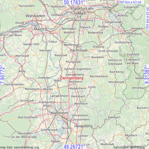
Zwingenberg GPS coordinates[2]
49° 43' 26.004" North, 8° 36' 39.024" East
| Map corner | latitude | longitude |
|---|---|---|
| Upper-left | 50.17631°, | 7.90772° |
| Center: | 49.72389°, | 8.61084° |
| Lower-right: | 49.26721°, | 9.31397° |
| Map W x H: | 101.1×101.1 km | = 62.8×62.8mi |
| max Lat: | 55.01917° ⇑70.8% North |
| Zwingenberg: | 49.72389° |
| min Lat: | ⇓29.2% South 47.40724° |
| min Long | Zwingenberg | max Long |
| 5.92978° | 8.61084° | 14.98853° |
| W 30%⇐ | ⇒70% E |
Elevation
Elevation of Zwingenberg is 99 m = 325 ft, and this is 150.1 m = 492 ft below average elevation for this country.
| Max E: |
1256 m = 4121 ft | 68.7% |
| Avg. | 249.1 m = 817 ft | |
| Zwingenberg | 99 m = 325 ft | |
Min E: |
-5 m = -16 ft | 31.3% |
See also: Germany elevation on elevation.city.
Geographical zone
Zwingenberg is located in North temperate zone (between Tropic of Cancer and the Arctic Circle). Distance of this North polar circle is 1872.4 km =1163.5 mi to North.| Distance of | km | miles | from Zwingenberg |
|---|---|---|---|
| North Pole | 4478.3 | 2782.7 | to North |
| Arctic Circle | 1872.4 | 1163.5 | to North |
| Tropic Cancer | 2922.9 | 1816.2 | to South |
| Equator | 5528.8 | 3435.4 | to South |


Nearby cities:
15 places around Zwingenberg: (largest is in red/bold)
• Alsbach-Hähnlein
2 km =1.2 mi,  326°
326°
• Bensheim
4.5 km =2.8 mi,  173°
173°
• Biblis
11.5 km =7.1 mi,  251°
251°
• Bickenbach
4 km =2.5 mi,  6°
6°
• Biebesheim
12.1 km =7.5 mi,  301°
301°
• Einhausen
6.9 km =4.3 mi,  220°
220°
• Gernsheim
9.4 km =5.8 mi,  290°
290°
• Groß-Rohrheim
9.2 km =5.7 mi,  268°
268°
• Heppenheim an der Bergstrasse
9.3 km =5.8 mi, 170°
• Laudenbach
12.7 km =7.9 mi, 165°
• Lindenfels
13.1 km =8.1 mi,  110°
110°
• Lorsch
8.8 km =5.5 mi,  201°
201°
• Lützelbach
11.4 km =7.1 mi,  79°
79°
• Pfungstadt
9.1 km =5.7 mi,  356°
356°
• Seeheim-Jugenheim
5.4 km =3.4 mi,  32°
32°
Sources, notices
• [Note1] Compared only with cities in Germany existing in our database
• [Src1] Map data: © OpenStreetMap contributors (CC-BY-SA)
• [Src2] Other city data from geonames.org with taken over terms of usage.
• [Src3] Geographical zone / Annual Mean Temperature by Robert A. Rohde @ Wikipedia
