Großbottwar geodata
Großbottwar (Baden-Württemberg) is a populated place; located in Germany in Europe/Berlin (GMT+2) time zone. With population of 8,294 people, there are 1904 cities with bigger population in this country. Compared to other cities in Germany, 83% of cities are located further ↑North; 60.8% of cities are located further →East and 50.4% of cities have higher elevation than Großbottwar. Note1
Administrative division(s):
- Level 1: Baden-Württemberg
- Level 2: Regierungsbezirk Stuttgart
- Level 3: Landkreis Ludwigsburg
- Level 4: Großbottwar


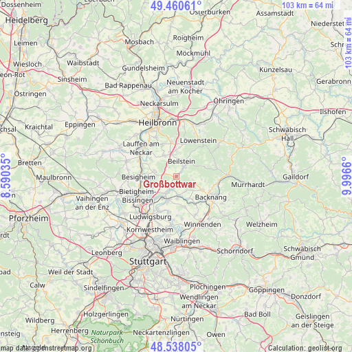
Großbottwar GPS coordinates[2]
49° 0' 5.292" North, 9° 17' 36.528" East
| Map corner | latitude | longitude |
|---|---|---|
| Upper-left | 49.46061°, | 8.59035° |
| Center: | 49.00147°, | 9.29348° |
| Lower-right: | 48.53805°, | 9.9966° |
| Map W x H: | 102.6×102.6 km | = 63.8×63.8mi |
| max Lat: | 55.01917° ⇑83% North |
| Großbottwar: | 49.00147° |
| min Lat: | ⇓17% South 47.40724° |
| min Long | Großbottwar | max Long |
| 5.92978° | 9.29348° | 14.98853° |
| W 39.2%⇐ | ⇒60.8% E |
Elevation
Elevation of Großbottwar is 222 m = 728 ft, and this is 27.1 m = 89 ft below average elevation for this country.
| Max E: |
1256 m = 4121 ft | 50.4% |
| Avg. | 249.1 m = 817 ft | |
| Großbottwar | 222 m = 728 ft | |
Min E: |
-5 m = -16 ft | 49.6% |
See also: Germany elevation on elevation.city.
Geographical zone
Großbottwar is located in North temperate zone (between Tropic of Cancer and the Arctic Circle). Distance of this North polar circle is 1952.7 km =1213.4 mi to North.| Distance of | km | miles | from Großbottwar |
|---|---|---|---|
| North Pole | 4558.6 | 2832.6 | to North |
| Arctic Circle | 1952.7 | 1213.4 | to North |
| Tropic Cancer | 2842.5 | 1766.2 | to South |
| Equator | 5448.5 | 3385.5 | to South |


Nearby cities:
15 places around Großbottwar: (largest is in red/bold)
• Abstatt
7.4 km =4.6 mi,  358°
358°
• Affalterbach
9 km =5.6 mi,  165°
165°
• Aspach
8.7 km =5.4 mi,  116°
116°
• Beilstein
4.7 km =2.9 mi,  18°
18°
• Benningen am Neckar
7.1 km =4.4 mi,  211°
211°
• Erdmannhausen
6.6 km =4.1 mi,  178°
178°
• Hessigheim
7.9 km =4.9 mi,  263°
263°
• Ilsfeld
6.9 km =4.3 mi,  330°
330°
• Kirchberg an der Murr
7.4 km =4.6 mi,  152°
152°
• Marbach am Neckar
7.3 km =4.5 mi,  199°
199°
• Mundelsheim
6.3 km =3.9 mi,  269°
269°
• Murr
5 km =3.1 mi, 209°
• Oberstenfeld
3.4 km =2.1 mi,  36°
36°
• Pleidelsheim
8.1 km =5 mi,  234°
234°
• Steinheim am der Murr
3.9 km =2.4 mi, 197°
Sources, notices
• [Note1] Compared only with cities in Germany existing in our database
• [Src1] Map data: © OpenStreetMap contributors (CC-BY-SA)
• [Src2] Other city data from geonames.org with taken over terms of usage.
• [Src3] Geographical zone / Annual Mean Temperature by Robert A. Rohde @ Wikipedia
