Gröbers geodata
Gröbers (Saxony-Anhalt) is a populated place; located in Germany in Europe/Berlin (GMT+2) time zone. With population of 2,460 people, there are 4485 cities with bigger population in this country. Compared to other cities in Germany, 65.2% of cities are located further ↓South; 83.4% of cities are located further ←West and 66.7% of cities have higher elevation than Gröbers. Note1


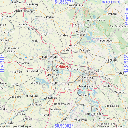
Gröbers GPS coordinates[2]
51° 25' 49.8" North, 12° 6' 58.428" East
| Map corner | latitude | longitude |
|---|---|---|
| Upper-left | 51.86677°, | 11.41311° |
| Center: | 51.4305°, | 12.11623° |
| Lower-right: | 50.99002°, | 12.81936° |
| Map W x H: | 97.5×97.5 km | = 60.6×60.6mi |
| max Lat: | 55.01917° ⇑34.8% North |
| Gröbers: | 51.4305° |
| min Lat: | ⇓65.2% South 47.40724° |
| min Long | Gröbers | max Long |
| 5.92978° | 12.11623° | 14.98853° |
| W 83.4%⇐ | ⇒16.6% E |
Elevation
Elevation of Gröbers is 110 m = 361 ft, and this is 139.1 m = 456 ft below average elevation for this country.
| Max E: |
1256 m = 4121 ft | 66.7% |
| Avg. | 249.1 m = 817 ft | |
| Gröbers | 110 m = 361 ft | |
Min E: |
-5 m = -16 ft | 33.3% |
See also: Germany elevation on elevation.city.
Geographical zone
Gröbers is located in North temperate zone (between Tropic of Cancer and the Arctic Circle). Distance of this North polar circle is 1682.6 km =1045.5 mi to North.| Distance of | km | miles | from Gröbers |
|---|---|---|---|
| North Pole | 4288.5 | 2664.7 | to North |
| Arctic Circle | 1682.6 | 1045.5 | to North |
| Tropic Cancer | 3112.6 | 1934.1 | to South |
| Equator | 5718.5 | 3553.3 | to South |


Nearby cities:
15 places around Gröbers: (largest is in red/bold)
• Dieskau
5.3 km =3.3 mi,  276°
276°
• Dölbau
5.8 km =3.6 mi,  314°
314°
• Döllnitz
6.6 km =4.1 mi,  247°
247°
• Ermlitz
5.2 km =3.2 mi,  145°
145°
• Großkugel
2.6 km =1.6 mi,  125°
125°
• Lochau
5.7 km =3.5 mi,  229°
229°
• Peißen
9 km =5.6 mi,  333°
333°
• Queis
5.2 km =3.2 mi,  14°
14°
• Raßnitz
4.7 km =2.9 mi,  199°
199°
• Reußen
7.9 km =4.9 mi, 7°
• Schkeuditz
8.2 km =5.1 mi,  117°
117°
• Sietzsch
7.9 km =4.9 mi,  32°
32°
• Wallendorf
8.4 km =5.2 mi, 199°
• Wiedemar
7.1 km =4.4 mi,  55°
55°
• Zöschen
8.1 km =5 mi,  179°
179°
Sources, notices
• [Note1] Compared only with cities in Germany existing in our database
• [Src1] Map data: © OpenStreetMap contributors (CC-BY-SA)
• [Src2] Other city data from geonames.org with taken over terms of usage.
• [Src3] Geographical zone / Annual Mean Temperature by Robert A. Rohde @ Wikipedia
