Zöschen geodata
Zöschen (Saxony-Anhalt) is a populated place; located in Germany in Europe/Berlin (GMT+2) time zone. With population of 1,074 people, there are 6925 cities with bigger population in this country. Compared to other cities in Germany, 64.1% of cities are located further ↓South; 83.4% of cities are located further ←West and 70.2% of cities have higher elevation than Zöschen. Note1


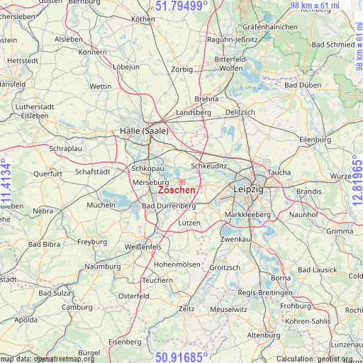
Zöschen GPS coordinates[2]
51° 21' 28.872" North, 12° 6' 59.472" East
| Map corner | latitude | longitude |
|---|---|---|
| Upper-left | 51.79499°, | 11.4134° |
| Center: | 51.35802°, | 12.11652° |
| Lower-right: | 50.91685°, | 12.81965° |
| Map W x H: | 97.6×97.6 km | = 60.6×60.6mi |
| max Lat: | 55.01917° ⇑35.9% North |
| Zöschen: | 51.35802° |
| min Lat: | ⇓64.1% South 47.40724° |
| min Long | Zöschen | max Long |
| 5.92978° | 12.11652° | 14.98853° |
| W 83.4%⇐ | ⇒16.6% E |
Elevation
Elevation of Zöschen is 90 m = 295 ft, and this is 159.1 m = 522 ft below average elevation for this country.
| Max E: |
1256 m = 4121 ft | 70.2% |
| Avg. | 249.1 m = 817 ft | |
| Zöschen | 90 m = 295 ft | |
Min E: |
-5 m = -16 ft | 29.8% |
See also: Germany elevation on elevation.city.
Geographical zone
Zöschen is located in North temperate zone (between Tropic of Cancer and the Arctic Circle). Distance of this North polar circle is 1690.7 km =1050.6 mi to North.| Distance of | km | miles | from Zöschen |
|---|---|---|---|
| North Pole | 4296.6 | 2669.8 | to North |
| Arctic Circle | 1690.7 | 1050.6 | to North |
| Tropic Cancer | 3104.6 | 1929.1 | to South |
| Equator | 5710.5 | 3548.3 | to South |


Nearby cities:
15 places around Zöschen: (largest is in red/bold)
• Bad Dürrenberg
7.8 km =4.8 mi,  206°
206°
• Döllnitz
8.3 km =5.2 mi,  312°
312°
• Ermlitz
4.8 km =3 mi,  38°
38°
• Großkugel
6.9 km =4.3 mi,  17°
17°
• Großlehna
6.9 km =4.3 mi,  145°
145°
• Gröbers
8.1 km =5 mi,  359°
359°
• Günthersdorf
4.1 km =2.5 mi,  109°
109°
• Kötschlitz
3.8 km =2.4 mi,  94°
94°
• Kötzschau
5.2 km =3.2 mi,  169°
169°
• Leuna
8.3 km =5.2 mi,  237°
237°
• Lochau
6.2 km =3.9 mi, 314°
• Ostrau
6.9 km =4.3 mi,  217°
217°
• Raßnitz
4 km =2.5 mi,  336°
336°
• Tollwitz
8.1 km =5 mi,  189°
189°
• Wallendorf
2.9 km =1.8 mi,  274°
274°
Sources, notices
• [Note1] Compared only with cities in Germany existing in our database
• [Src1] Map data: © OpenStreetMap contributors (CC-BY-SA)
• [Src2] Other city data from geonames.org with taken over terms of usage.
• [Src3] Geographical zone / Annual Mean Temperature by Robert A. Rohde @ Wikipedia
