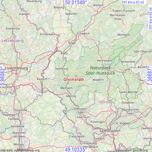
Greimerath geodata
Greimerath (Rheinland-Pfalz) is a seat of a fourth-order administrative division; located in Germany in Europe/Berlin (GMT+2) time zone. With population of 1,019 people, there are 7121 cities with bigger population in this country. Compared to other cities in Germany, 74.6% of cities are located further ↑North; 96.5% of cities are located further →East and 80.5% of cities have lower elevation than Greimerath. Note1
Administrative division(s):
- Level 1: Rheinland-Pfalz
- Level 3: Landkreis Trier-Saarburg
- Level 4: Greimerath


Greimerath GPS coordinates[2]
49° 33' 41.58" North, 6° 41' 1.464" East
| Map corner | latitude | longitude |
|---|---|---|
| Upper-left | 50.01549°, | 5.98062° |
| Center: | 49.56155°, | 6.68374° |
| Lower-right: | 49.10335°, | 7.38687° |
| Map W x H: | 101.4×101.4 km | = 63×63mi |
| max Lat: | 55.01917° ⇑74.6% North |
| Greimerath: | 49.56155° |
| min Lat: | ⇓25.4% South 47.40724° |
| min Long | Greimerath | max Long |
| 5.92978° | 6.68374° | 14.98853° |
| W 3.5%⇐ | ⇒96.5% E |
Elevation
Elevation of Greimerath is 436 m = 1430 ft, and this is 186.9 m = 613 ft above average elevation for this country.
| Max E: |
1256 m = 4121 ft | 19.5% |
| Greimerath | 436 m 1430 ft | |
| Avg. | 249.1 m = 817 ft | |
Min E: |
-5 m = -16 ft | 80.5% |
See also: Germany elevation on elevation.city.
Geographical zone
Greimerath is located in North temperate zone (between Tropic of Cancer and the Arctic Circle). Distance of this North polar circle is 1890.4 km =1174.6 mi to North.| Distance of | km | miles | from Greimerath |
|---|---|---|---|
| North Pole | 4496.3 | 2793.9 | to North |
| Arctic Circle | 1890.4 | 1174.6 | to North |
| Tropic Cancer | 2904.8 | 1805 | to South |
| Equator | 5510.7 | 3424.2 | to South |


Nearby cities:
15 places around Greimerath: (largest is in red/bold)
• Baldringen
6.1 km =3.8 mi,  359°
359°
• Britten
4.6 km =2.9 mi,  186°
186°
• Hentern
6.2 km =3.9 mi,  10°
10°
• Irsch
8 km =5 mi,  307°
307°
• Kastel-Staadt
9 km =5.6 mi,  272°
272°
• Losheim
7.3 km =4.5 mi,  142°
142°
• Mandern
7.3 km =4.5 mi,  54°
54°
• Ockfen
9.5 km =5.9 mi, 310°
• Paschel
8 km =5 mi, 359°
• Saarhölzbach
7.5 km =4.7 mi,  227°
227°
• Schömerich
8.1 km =5 mi, 8°
• Serrig
8 km =5 mi,  280°
280°
• Taben-Rodt
7.4 km =4.6 mi,  259°
259°
• Weiskirchen
9.7 km =6 mi,  97°
97°
• Zerf
4.3 km =2.7 mi, 359°
Sources, notices
• [Note1] Compared only with cities in Germany existing in our database
• [Src1] Map data: © OpenStreetMap contributors (CC-BY-SA)
• [Src2] Other city data from geonames.org with taken over terms of usage.
• [Src3] Geographical zone / Annual Mean Temperature by Robert A. Rohde @ Wikipedia
