Weiskirchen geodata
Weiskirchen (Saarland) is a seat of a fourth-order administrative division; located in Germany in Europe/Berlin (GMT+2) time zone. With population of 6,316 people, there are 2358 cities with bigger population in this country. Compared to other cities in Germany, 74.8% of cities are located further ↑North; 95.5% of cities are located further →East and 69.2% of cities have lower elevation than Weiskirchen. Note1


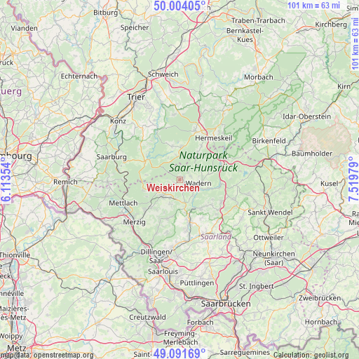
Weiskirchen GPS coordinates[2]
49° 33' 0" North, 6° 49' 0.012" East
| Map corner | latitude | longitude |
|---|---|---|
| Upper-left | 50.00405°, | 6.11354° |
| Center: | 49.55°, | 6.81667° |
| Lower-right: | 49.09169°, | 7.51979° |
| Map W x H: | 101.4×101.4 km | = 63×63mi |
| max Lat: | 55.01917° ⇑74.8% North |
| Weiskirchen: | 49.55° |
| min Lat: | ⇓25.2% South 47.40724° |
| min Long | Weiskirchen | max Long |
| 5.92978° | 6.81667° | 14.98853° |
| W 4.5%⇐ | ⇒95.5% E |
Elevation
Elevation of Weiskirchen is 352 m = 1155 ft, and this is 102.9 m = 338 ft above average elevation for this country.
| Max E: |
1256 m = 4121 ft | 30.8% |
| Weiskirchen | 352 m 1155 ft | |
| Avg. | 249.1 m = 817 ft | |
Min E: |
-5 m = -16 ft | 69.2% |
See also: Germany elevation on elevation.city.
Geographical zone
Weiskirchen is located in North temperate zone (between Tropic of Cancer and the Arctic Circle). Distance of this North polar circle is 1891.7 km =1175.4 mi to North.| Distance of | km | miles | from Weiskirchen |
|---|---|---|---|
| North Pole | 4497.6 | 2794.7 | to North |
| Arctic Circle | 1891.7 | 1175.4 | to North |
| Tropic Cancer | 2903.5 | 1804.2 | to South |
| Equator | 5509.4 | 3423.4 | to South |


Nearby cities:
15 places around Weiskirchen: (largest is in red/bold)
• Baldringen
12.1 km =7.5 mi,  307°
307°
• Britten
10.6 km =6.6 mi,  252°
252°
• Greimerath
9.7 km =6 mi,  277°
277°
• Grimburg
8.8 km =5.5 mi,  32°
32°
• Gusenburg
11 km =6.8 mi, 32°
• Heddert
12.1 km =7.5 mi,  336°
336°
• Hentern
11.2 km =7 mi, 311°
• Kell
9.4 km =5.8 mi,  3°
3°
• Kell am See
9.2 km =5.7 mi, 2°
• Losheim
6.8 km =4.2 mi,  229°
229°
• Mandern
6.6 km =4.1 mi,  327°
327°
• Schillingen
9.6 km =6 mi,  345°
345°
• Wadern
5.2 km =3.2 mi,  100°
100°
• Waldweiler
7.5 km =4.7 mi, 350°
• Zerf
11.1 km =6.9 mi,  300°
300°
Sources, notices
• [Note1] Compared only with cities in Germany existing in our database
• [Src1] Map data: © OpenStreetMap contributors (CC-BY-SA)
• [Src2] Other city data from geonames.org with taken over terms of usage.
• [Src3] Geographical zone / Annual Mean Temperature by Robert A. Rohde @ Wikipedia
