Düvier geodata
Düvier (Mecklenburg-Vorpommern) is a populated place; located in Germany in Europe/Berlin (GMT+2) time zone. With population of 564 people, there are 9006 cities with bigger population in this country. Compared to other cities in Germany, 92.8% of cities are located further ↓South; 92.7% of cities are located further ←West and 92.3% of cities have higher elevation than Düvier. Note1
Administrative division(s):
- Level 1: Mecklenburg-Vorpommern
- Level 3: Vorpommern-Greifswald
- Level 4: Loitz


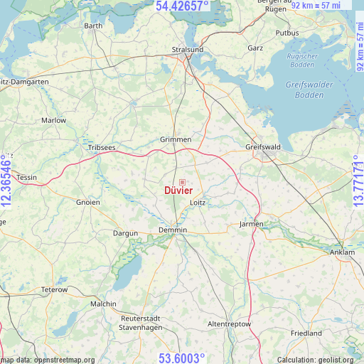
Düvier GPS coordinates[2]
54° 0' 55.764" North, 13° 4' 6.888" East
| Map corner | latitude | longitude |
|---|---|---|
| Upper-left | 54.42657°, | 12.36546° |
| Center: | 54.01549°, | 13.06858° |
| Lower-right: | 53.6003°, | 13.77171° |
| Map W x H: | 91.9×91.9 km | = 57.1×57.1mi |
| max Lat: | 55.01917° ⇑7.2% North |
| Düvier: | 54.01549° |
| min Lat: | ⇓92.8% South 47.40724° |
| min Long | Düvier | max Long |
| 5.92978° | 13.06858° | 14.98853° |
| W 92.7%⇐ | ⇒7.3% E |
Elevation
Elevation of Düvier is 15 m = 49 ft, and this is 234.1 m = 768 ft below average elevation for this country.
| Max E: |
1256 m = 4121 ft | 92.3% |
| Avg. | 249.1 m = 817 ft | |
| Düvier | 15 m = 49 ft | |
Min E: |
-5 m = -16 ft | 7.7% |
See also: Germany elevation on elevation.city.
Geographical zone
Düvier is located in North temperate zone (between Tropic of Cancer and the Arctic Circle). Distance of this North polar circle is 1395.2 km =866.9 mi to North.| Distance of | km | miles | from Düvier |
|---|---|---|---|
| North Pole | 4001.1 | 2486.2 | to North |
| Arctic Circle | 1395.2 | 866.9 | to North |
| Tropic Cancer | 3400 | 2112.7 | to South |
| Equator | 6006 | 3732 | to South |


Nearby cities:
15 places around Düvier: (largest is in red/bold)
• Bentzin
15.4 km =9.6 mi,  119°
119°
• Demmin
12.2 km =7.6 mi,  191°
191°
• Dersekow
15 km =9.3 mi,  77°
77°
• Glewitz
9.4 km =5.8 mi,  273°
273°
• Grammendorf
12.9 km =8 mi,  280°
280°
• Gransebieth
13.3 km =8.3 mi,  294°
294°
• Grimmen
10.9 km =6.8 mi,  350°
350°
• Görmin
13.5 km =8.4 mi,  101°
101°
• Nossendorf
9.3 km =5.8 mi,  230°
230°
• Sassen
7.8 km =4.8 mi, 83°
• Splietsdorf
15 km =9.3 mi,  323°
323°
• Stoltenhagen
15.8 km =9.8 mi,  2°
2°
• Tutow
16.2 km =10.1 mi,  133°
133°
• Wendisch Baggendorf
10.4 km =6.5 mi,  308°
308°
• Ückeritz
12.8 km =8 mi,  143°
143°
Sources, notices
• [Note1] Compared only with cities in Germany existing in our database
• [Src1] Map data: © OpenStreetMap contributors (CC-BY-SA)
• [Src2] Other city data from geonames.org with taken over terms of usage.
• [Src3] Geographical zone / Annual Mean Temperature by Robert A. Rohde @ Wikipedia
