Golmbach geodata
Golmbach (Lower Saxony) is a seat of a fourth-order administrative division; located in Germany in Europe/Berlin (GMT+2) time zone. With population of 1,042 people, there are 7044 cities with bigger population in this country. Compared to other cities in Germany, 71.1% of cities are located further ↓South; 57.1% of cities are located further →East and 62% of cities have higher elevation than Golmbach. Note1


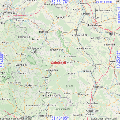
Golmbach GPS coordinates[2]
51° 54' 0" North, 9° 33' 0" East
| Map corner | latitude | longitude |
|---|---|---|
| Upper-left | 52.33176°, | 8.84688° |
| Center: | 51.9°, | 9.55° |
| Lower-right: | 51.46405°, | 10.25313° |
| Map W x H: | 96.5×96.5 km | = 60×60mi |
| max Lat: | 55.01917° ⇑28.9% North |
| Golmbach: | 51.9° |
| min Lat: | ⇓71.1% South 47.40724° |
| min Long | Golmbach | max Long |
| 5.92978° | 9.55° | 14.98853° |
| W 42.9%⇐ | ⇒57.1% E |
Elevation
Elevation of Golmbach is 138 m = 453 ft, and this is 111.1 m = 365 ft below average elevation for this country.
| Max E: |
1256 m = 4121 ft | 62% |
| Avg. | 249.1 m = 817 ft | |
| Golmbach | 138 m = 453 ft | |
Min E: |
-5 m = -16 ft | 38% |
See also: Germany elevation on elevation.city.
Geographical zone
Golmbach is located in North temperate zone (between Tropic of Cancer and the Arctic Circle). Distance of this North polar circle is 1630.4 km =1013.1 mi to North.| Distance of | km | miles | from Golmbach |
|---|---|---|---|
| North Pole | 4236.3 | 2632.3 | to North |
| Arctic Circle | 1630.4 | 1013.1 | to North |
| Tropic Cancer | 3164.8 | 1966.5 | to South |
| Equator | 5770.7 | 3585.7 | to South |


Nearby cities:
15 places around Golmbach: (largest is in red/bold)
• Arholzen
3.9 km =2.4 mi,  162°
162°
• Bevern
6 km =3.7 mi,  219°
219°
• Bodenwerder
8.2 km =5.1 mi,  345°
345°
• Deensen
5.3 km =3.3 mi,  145°
145°
• Dielmissen
8.8 km =5.5 mi,  26°
26°
• Eschershausen
7 km =4.3 mi,  65°
65°
• Heinsen
8.2 km =5.1 mi,  256°
256°
• Holenberg
2.9 km =1.8 mi,  50°
50°
• Holzen
8.8 km =5.5 mi, 65°
• Kirchbrak
7.5 km =4.7 mi,  13°
13°
• Lenne
9.2 km =5.7 mi,  94°
94°
• Lüerdissen
7.8 km =4.8 mi,  41°
41°
• Negenborn
2.2 km =1.4 mi, 148°
• Pegestorf
4.8 km =3 mi,  310°
310°
• Stadtoldendorf
5.6 km =3.5 mi,  110°
110°
Sources, notices
• [Note1] Compared only with cities in Germany existing in our database
• [Src1] Map data: © OpenStreetMap contributors (CC-BY-SA)
• [Src2] Other city data from geonames.org with taken over terms of usage.
• [Src3] Geographical zone / Annual Mean Temperature by Robert A. Rohde @ Wikipedia
