Lenne geodata
Lenne (Lower Saxony) is a seat of a fourth-order administrative division; located in Germany in Europe/Berlin (GMT+2) time zone. With population of 752 people, there are 8089 cities with bigger population in this country. Compared to other cities in Germany, 71% of cities are located further ↓South; 54.7% of cities are located further →East and 52.1% of cities have higher elevation than Lenne. Note1


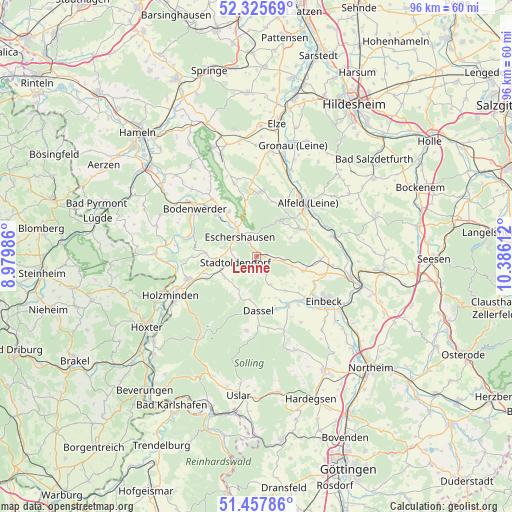
Lenne GPS coordinates[2]
51° 53' 37.932" North, 9° 40' 58.764" East
| Map corner | latitude | longitude |
|---|---|---|
| Upper-left | 52.32569°, | 8.97986° |
| Center: | 51.89387°, | 9.68299° |
| Lower-right: | 51.45786°, | 10.38612° |
| Map W x H: | 96.5×96.5 km | = 60×60mi |
| max Lat: | 55.01917° ⇑29% North |
| Lenne: | 51.89387° |
| min Lat: | ⇓71% South 47.40724° |
| min Long | Lenne | max Long |
| 5.92978° | 9.68299° | 14.98853° |
| W 45.3%⇐ | ⇒54.7% E |
Elevation
Elevation of Lenne is 211 m = 692 ft, and this is 38.1 m = 125 ft below average elevation for this country.
| Max E: |
1256 m = 4121 ft | 52.1% |
| Avg. | 249.1 m = 817 ft | |
| Lenne | 211 m = 692 ft | |
Min E: |
-5 m = -16 ft | 47.9% |
See also: Germany elevation on elevation.city.
Geographical zone
Lenne is located in North temperate zone (between Tropic of Cancer and the Arctic Circle). Distance of this North polar circle is 1631.1 km =1013.5 mi to North.| Distance of | km | miles | from Lenne |
|---|---|---|---|
| North Pole | 4237 | 2632.7 | to North |
| Arctic Circle | 1631.1 | 1013.5 | to North |
| Tropic Cancer | 3164.1 | 1966.1 | to South |
| Equator | 5770.1 | 3585.4 | to South |


Nearby cities:
15 places around Lenne: (largest is in red/bold)
• Arholzen
8.5 km =5.3 mi,  249°
249°
• Dassel
10.2 km =6.3 mi,  177°
177°
• Deensen
7.2 km =4.5 mi,  238°
238°
• Delligsen
9.8 km =6.1 mi,  57°
57°
• Dielmissen
10 km =6.2 mi,  328°
328°
• Eimen
7 km =4.3 mi,  99°
99°
• Eschershausen
4.6 km =2.9 mi,  322°
322°
• Golmbach
9.2 km =5.7 mi,  274°
274°
• Heinade
7.5 km =4.7 mi,  206°
206°
• Holenberg
7.3 km =4.5 mi,  290°
290°
• Holzen
4.5 km =2.8 mi,  345°
345°
• Lüerdissen
7.7 km =4.8 mi, 328°
• Negenborn
8.1 km =5 mi,  261°
261°
• Stadtoldendorf
4.1 km =2.5 mi, 251°
• Wangelnstedt
3 km =1.9 mi, 179°
Sources, notices
• [Note1] Compared only with cities in Germany existing in our database
• [Src1] Map data: © OpenStreetMap contributors (CC-BY-SA)
• [Src2] Other city data from geonames.org with taken over terms of usage.
• [Src3] Geographical zone / Annual Mean Temperature by Robert A. Rohde @ Wikipedia
