Fuhlendorf geodata
Fuhlendorf (Mecklenburg-Vorpommern) is a populated place; located in Germany in Europe/Berlin (GMT+2) time zone. With population of 997 people, there are 7196 cities with bigger population in this country. Compared to other cities in Germany, 97% of cities are located further ↓South; 88.9% of cities are located further ←West and 98.6% of cities have higher elevation than Fuhlendorf. Note1
Administrative division(s):
- Level 1: Mecklenburg-Vorpommern
- Level 3: Vorpommern-Rügen
- Level 4: Fuhlendorf


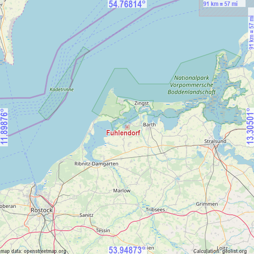
Fuhlendorf GPS coordinates[2]
54° 21' 37.728" North, 12° 36' 6.768" East
| Map corner | latitude | longitude |
|---|---|---|
| Upper-left | 54.76814°, | 11.89876° |
| Center: | 54.36048°, | 12.60188° |
| Lower-right: | 53.94873°, | 13.30501° |
| Map W x H: | 91.1×91.1 km | = 56.6×56.6mi |
| max Lat: | 55.01917° ⇑3% North |
| Fuhlendorf: | 54.36048° |
| min Lat: | ⇓97% South 47.40724° |
| min Long | Fuhlendorf | max Long |
| 5.92978° | 12.60188° | 14.98853° |
| W 88.9%⇐ | ⇒11.1% E |
Elevation
Elevation of Fuhlendorf is 1 m = 3 ft, and this is 248.1 m = 814 ft below average elevation for this country.
| Max E: |
1256 m = 4121 ft | 98.6% |
| Avg. | 249.1 m = 817 ft | |
| Fuhlendorf | 1 m = 3 ft | |
Min E: |
-5 m = -16 ft | 1.4% |
See also: Germany elevation on elevation.city.
Geographical zone
Fuhlendorf is located in North temperate zone (between Tropic of Cancer and the Arctic Circle). Distance of this North polar circle is 1356.9 km =843.1 mi to North.| Distance of | km | miles | from Fuhlendorf |
|---|---|---|---|
| North Pole | 3962.7 | 2462.3 | to North |
| Arctic Circle | 1356.9 | 843.1 | to North |
| Tropic Cancer | 3438.4 | 2136.5 | to South |
| Equator | 6044.3 | 3755.8 | to South |


Nearby cities:
15 places around Fuhlendorf: (largest is in red/bold)
• Barth
8 km =5 mi,  87°
87°
• Born
5.4 km =3.4 mi,  300°
300°
• Löbnitz
10.5 km =6.5 mi,  133°
133°
• Niepars
21.5 km =13.4 mi,  103°
103°
• Ostseebad Ahrenshoop
11.8 km =7.3 mi,  282°
282°
• Ostseebad Dierhagen
17.5 km =10.9 mi,  244°
244°
• Ostseebad Prerow
9.5 km =5.9 mi,  350°
350°
• Pruchten
5.1 km =3.2 mi,  66°
66°
• Ribnitz-Damgarten
16.2 km =10.1 mi,  215°
215°
• Saal
8.7 km =5.4 mi,  230°
230°
• Semlow
20.3 km =12.6 mi,  169°
169°
• Trinwillershagen
12.3 km =7.6 mi, 173°
• Velgast
16.7 km =10.4 mi, 125°
• Wieck
5.6 km =3.5 mi, 346°
• Zingst
10.1 km =6.3 mi,  33°
33°
Sources, notices
• [Note1] Compared only with cities in Germany existing in our database
• [Src1] Map data: © OpenStreetMap contributors (CC-BY-SA)
• [Src2] Other city data from geonames.org with taken over terms of usage.
• [Src3] Geographical zone / Annual Mean Temperature by Robert A. Rohde @ Wikipedia
