Friedersdorf geodata
Friedersdorf (Saxony) is a populated place; located in Germany in Europe/Berlin (GMT+2) time zone. With population of 1,512 people, there are 5859 cities with bigger population in this country. Compared to other cities in Germany, 58.5% of cities are located further ↓South; 99.4% of cities are located further ←West and 67% of cities have lower elevation than Friedersdorf. Note1


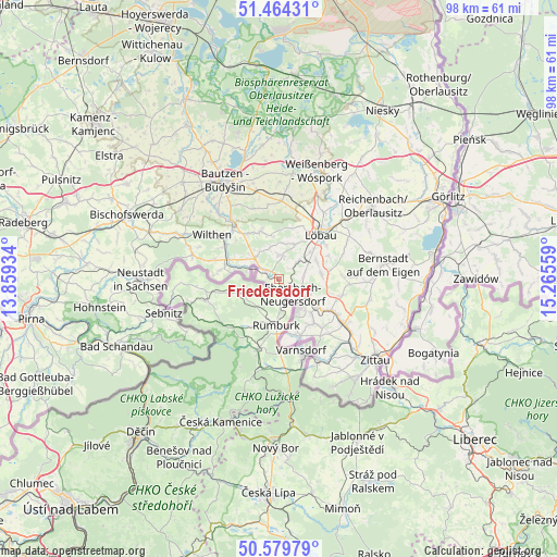
Friedersdorf GPS coordinates[2]
51° 1' 26.976" North, 14° 33' 44.856" East
| Map corner | latitude | longitude |
|---|---|---|
| Upper-left | 51.46431°, | 13.85934° |
| Center: | 51.02416°, | 14.56246° |
| Lower-right: | 50.57979°, | 15.26559° |
| Map W x H: | 98.3×98.3 km | = 61.1×61.1mi |
| max Lat: | 55.01917° ⇑41.5% North |
| Friedersdorf: | 51.02416° |
| min Lat: | ⇓58.5% South 47.40724° |
| min Long | Friedersdorf | max Long |
| 5.92978° | 14.56246° | 14.98853° |
| W 99.4%⇐ | ⇒0.59999999999999% E |
Elevation
Elevation of Friedersdorf is 335 m = 1099 ft, and this is 85.9 m = 282 ft above average elevation for this country.
| Max E: |
1256 m = 4121 ft | 33% |
| Friedersdorf | 335 m 1099 ft | |
| Avg. | 249.1 m = 817 ft | |
Min E: |
-5 m = -16 ft | 67% |
See also: Germany elevation on elevation.city.
Geographical zone
Friedersdorf is located in North temperate zone (between Tropic of Cancer and the Arctic Circle). Distance of this North polar circle is 1727.8 km =1073.6 mi to North.| Distance of | km | miles | from Friedersdorf |
|---|---|---|---|
| North Pole | 4333.7 | 2692.8 | to North |
| Arctic Circle | 1727.8 | 1073.6 | to North |
| Tropic Cancer | 3067.4 | 1906 | to South |
| Equator | 5673.4 | 3525.3 | to South |


Nearby cities:
15 places around Friedersdorf: (largest is in red/bold)
• Beiersdorf
5.8 km =3.6 mi,  343°
343°
• Crostau
10 km =6.2 mi,  312°
312°
• Cunewalde
9 km =5.6 mi, 339°
• Dürrhennersdorf
4 km =2.5 mi,  46°
46°
• Ebersbach
2.5 km =1.6 mi,  137°
137°
• Eibau
8.4 km =5.2 mi,  123°
123°
• Großschweidnitz
7.5 km =4.7 mi, 48°
• Lawalde
7.1 km =4.4 mi,  21°
21°
• Leutersdorf
10.3 km =6.4 mi, 143°
• Neugersdorf
6.1 km =3.8 mi,  148°
148°
• Neusalza-Spremberg
2.5 km =1.6 mi, 312°
• Niedercunnersdorf
7.5 km =4.7 mi,  63°
63°
• Oppach
6.4 km =4 mi,  317°
317°
• Schönbach
4.7 km =2.9 mi,  3°
3°
• Sohland
10.2 km =6.3 mi,  280°
280°
Sources, notices
• [Note1] Compared only with cities in Germany existing in our database
• [Src1] Map data: © OpenStreetMap contributors (CC-BY-SA)
• [Src2] Other city data from geonames.org with taken over terms of usage.
• [Src3] Geographical zone / Annual Mean Temperature by Robert A. Rohde @ Wikipedia
