Cunewalde geodata
Cunewalde (Saxony) is a seat of a fourth-order administrative division; located in Germany in Europe/Berlin (GMT+2) time zone. With population of 5,601 people, there are 2593 cities with bigger population in this country. Compared to other cities in Germany, 59.9% of cities are located further ↓South; 99.3% of cities are located further ←West and 60% of cities have lower elevation than Cunewalde. Note1


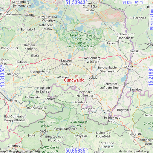
Cunewalde GPS coordinates[2]
51° 6' 0" North, 14° 31' 0.012" East
| Map corner | latitude | longitude |
|---|---|---|
| Upper-left | 51.53943°, | 13.81355° |
| Center: | 51.1°, | 14.51667° |
| Lower-right: | 50.65635°, | 15.2198° |
| Map W x H: | 98.2×98.2 km | = 61×61mi |
| max Lat: | 55.01917° ⇑40.1% North |
| Cunewalde: | 51.1° |
| min Lat: | ⇓59.9% South 47.40724° |
| min Long | Cunewalde | max Long |
| 5.92978° | 14.51667° | 14.98853° |
| W 99.3%⇐ | ⇒0.7% E |
Elevation
Elevation of Cunewalde is 290 m = 951 ft, and this is 40.9 m = 134 ft above average elevation for this country.
| Max E: |
1256 m = 4121 ft | 40% |
| Cunewalde | 290 m 951 ft | |
| Avg. | 249.1 m = 817 ft | |
Min E: |
-5 m = -16 ft | 60% |
See also: Germany elevation on elevation.city.
Geographical zone
Cunewalde is located in North temperate zone (between Tropic of Cancer and the Arctic Circle). Distance of this North polar circle is 1719.4 km =1068.4 mi to North.| Distance of | km | miles | from Cunewalde |
|---|---|---|---|
| North Pole | 4325.3 | 2687.6 | to North |
| Arctic Circle | 1719.4 | 1068.4 | to North |
| Tropic Cancer | 3075.9 | 1911.3 | to South |
| Equator | 5681.8 | 3530.5 | to South |


Nearby cities:
15 places around Cunewalde: (largest is in red/bold)
• Beiersdorf
3.3 km =2.1 mi,  152°
152°
• Crostau
4.6 km =2.9 mi,  248°
248°
• Dürrhennersdorf
8.3 km =5.2 mi,  133°
133°
• Friedersdorf
9 km =5.6 mi,  159°
159°
• Großpostwitz
5.8 km =3.6 mi,  293°
293°
• Hochkirch
6.6 km =4.1 mi,  34°
34°
• Kirschau
6.2 km =3.9 mi,  262°
262°
• Kubschütz
7.5 km =4.7 mi,  351°
351°
• Lawalde
6.1 km =3.8 mi,  107°
107°
• Neusalza-Spremberg
6.9 km =4.3 mi,  168°
168°
• Obergurig
8.6 km =5.3 mi,  295°
295°
• Oppach
3.9 km =2.4 mi,  197°
197°
• Schirgiswalde
6.7 km =4.2 mi, 246°
• Schönbach
5.1 km =3.2 mi,  136°
136°
• Wilthen
8.6 km =5.3 mi,  268°
268°
Sources, notices
• [Note1] Compared only with cities in Germany existing in our database
• [Src1] Map data: © OpenStreetMap contributors (CC-BY-SA)
• [Src2] Other city data from geonames.org with taken over terms of usage.
• [Src3] Geographical zone / Annual Mean Temperature by Robert A. Rohde @ Wikipedia
