Freudenberg geodata
Freudenberg (Bavaria) is a seat of a fourth-order administrative division; located in Germany in Europe/Berlin (GMT+2) time zone. With population of 4,268 people, there are 3152 cities with bigger population in this country. Compared to other cities in Germany, 76% of cities are located further ↑North; 81.6% of cities are located further ←West and 86.2% of cities have lower elevation than Freudenberg. Note1
Administrative division(s):
- Level 1: Bavaria
- Level 2: Upper Palatinate
- Level 3: Landkreis Amberg-Sulzbach
- Level 4: Freudenberg


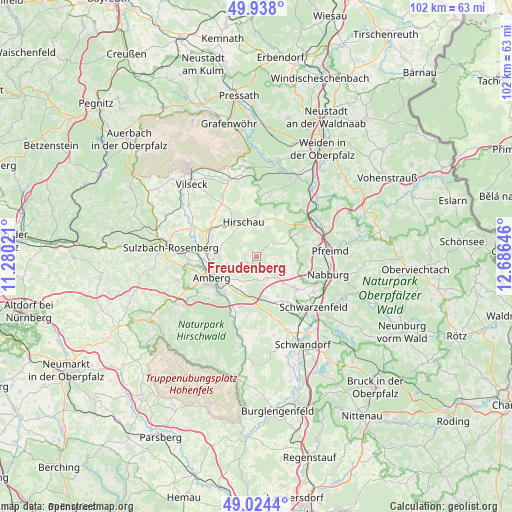
Freudenberg GPS coordinates[2]
49° 28' 59.988" North, 11° 58' 59.988" East
| Map corner | latitude | longitude |
|---|---|---|
| Upper-left | 49.938°, | 11.28021° |
| Center: | 49.48333°, | 11.98333° |
| Lower-right: | 49.0244°, | 12.68646° |
| Map W x H: | 101.6×101.6 km | = 63.1×63.1mi |
| max Lat: | 55.01917° ⇑76% North |
| Freudenberg: | 49.48333° |
| min Lat: | ⇓24% South 47.40724° |
| min Long | Freudenberg | max Long |
| 5.92978° | 11.98333° | 14.98853° |
| W 81.6%⇐ | ⇒18.4% E |
Elevation
Elevation of Freudenberg is 479 m = 1572 ft, and this is 229.9 m = 754 ft above average elevation for this country.
| Max E: |
1256 m = 4121 ft | 13.8% |
| Freudenberg | 479 m 1572 ft | |
| Avg. | 249.1 m = 817 ft | |
Min E: |
-5 m = -16 ft | 86.2% |
See also: Germany elevation on elevation.city.
Geographical zone
Freudenberg is located in North temperate zone (between Tropic of Cancer and the Arctic Circle). Distance of this North polar circle is 1899.1 km =1180 mi to North.| Distance of | km | miles | from Freudenberg |
|---|---|---|---|
| North Pole | 4505 | 2799.3 | to North |
| Arctic Circle | 1899.1 | 1180 | to North |
| Tropic Cancer | 2896.1 | 1799.6 | to South |
| Equator | 5502 | 3418.8 | to South |


Nearby cities:
15 places around Freudenberg: (largest is in red/bold)
• Amberg
9.8 km =6.1 mi,  242°
242°
• Breitenbrunn
13.5 km =8.4 mi,  168°
168°
• Ebermannsdorf
10.5 km =6.5 mi,  199°
199°
• Gebenbach
10 km =6.2 mi,  306°
306°
• Hahnbach
14.2 km =8.8 mi,  293°
293°
• Hirschau
7.3 km =4.5 mi,  338°
338°
• Kohlberg
12.3 km =7.6 mi,  12°
12°
• Kümmersbruck
9.9 km =6.2 mi,  223°
223°
• Nabburg
14.6 km =9.1 mi,  103°
103°
• Pfreimd
14.3 km =8.9 mi,  86°
86°
• Poppenricht
13.4 km =8.3 mi,  266°
266°
• Schmidgaden
10.3 km =6.4 mi,  130°
130°
• Schnaittenbach
7.2 km =4.5 mi, 10°
• Stulln
13.1 km =8.1 mi,  124°
124°
• Wernberg-Köblitz
14.3 km =8.9 mi,  64°
64°
Sources, notices
• [Note1] Compared only with cities in Germany existing in our database
• [Src1] Map data: © OpenStreetMap contributors (CC-BY-SA)
• [Src2] Other city data from geonames.org with taken over terms of usage.
• [Src3] Geographical zone / Annual Mean Temperature by Robert A. Rohde @ Wikipedia
