Poppenricht geodata
Poppenricht (Bavaria) is a seat of a fourth-order administrative division; located in Germany in Europe/Berlin (GMT+2) time zone. With population of 3,319 people, there are 3743 cities with bigger population in this country. Compared to other cities in Germany, 76.1% of cities are located further ↑North; 78.7% of cities are located further ←West and 78% of cities have lower elevation than Poppenricht. Note1
Administrative division(s):
- Level 1: Bavaria
- Level 2: Upper Palatinate
- Level 3: Landkreis Amberg-Sulzbach
- Level 4: Poppenricht


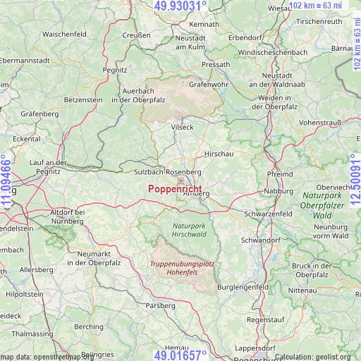
Poppenricht GPS coordinates[2]
49° 28' 32.052" North, 11° 47' 52.008" East
| Map corner | latitude | longitude |
|---|---|---|
| Upper-left | 49.93031°, | 11.09466° |
| Center: | 49.47557°, | 11.79778° |
| Lower-right: | 49.01657°, | 12.50091° |
| Map W x H: | 101.6×101.6 km | = 63.1×63.1mi |
| max Lat: | 55.01917° ⇑76.1% North |
| Poppenricht: | 49.47557° |
| min Lat: | ⇓23.9% South 47.40724° |
| min Long | Poppenricht | max Long |
| 5.92978° | 11.79778° | 14.98853° |
| W 78.7%⇐ | ⇒21.3% E |
Elevation
Elevation of Poppenricht is 419 m = 1375 ft, and this is 169.9 m = 557 ft above average elevation for this country.
| Max E: |
1256 m = 4121 ft | 22% |
| Poppenricht | 419 m 1375 ft | |
| Avg. | 249.1 m = 817 ft | |
Min E: |
-5 m = -16 ft | 78% |
See also: Germany elevation on elevation.city.
Geographical zone
Poppenricht is located in North temperate zone (between Tropic of Cancer and the Arctic Circle). Distance of this North polar circle is 1900 km =1180.6 mi to North.| Distance of | km | miles | from Poppenricht |
|---|---|---|---|
| North Pole | 4505.9 | 2799.8 | to North |
| Arctic Circle | 1900 | 1180.6 | to North |
| Tropic Cancer | 2895.2 | 1799 | to South |
| Equator | 5501.2 | 3418.3 | to South |


Nearby cities:
15 places around Poppenricht: (largest is in red/bold)
• Amberg
5.9 km =3.7 mi,  127°
127°
• Ammerthal
4.6 km =2.9 mi,  214°
214°
• Ebermannsdorf
13.5 km =8.4 mi, 132°
• Edelsfeld
13.4 km =8.3 mi,  326°
326°
• Etzelwang
16.3 km =10.1 mi,  290°
290°
• Freudenberg
13.4 km =8.3 mi,  86°
86°
• Gebenbach
8.7 km =5.4 mi,  37°
37°
• Hahnbach
6.5 km =4 mi,  3°
3°
• Hirschau
13.1 km =8.1 mi,  54°
54°
• Illschwang
8.7 km =5.4 mi,  251°
251°
• Kastl
14.4 km =8.9 mi,  215°
215°
• Kümmersbruck
9.1 km =5.7 mi, 133°
• Sulzbach-Rosenberg
4.7 km =2.9 mi,  307°
307°
• Ursensollen
8.7 km =5.4 mi,  200°
200°
• Vilseck
15.5 km =9.6 mi, 1°
Sources, notices
• [Note1] Compared only with cities in Germany existing in our database
• [Src1] Map data: © OpenStreetMap contributors (CC-BY-SA)
• [Src2] Other city data from geonames.org with taken over terms of usage.
• [Src3] Geographical zone / Annual Mean Temperature by Robert A. Rohde @ Wikipedia
