Schwarzbach geodata
Schwarzbach (Brandenburg) is a seat of a fourth-order administrative division; located in Germany in Europe/Berlin (GMT+2) time zone. With population of 827 people, there are 7791 cities with bigger population in this country. Compared to other cities in Germany, 65.5% of cities are located further ↓South; 97.7% of cities are located further ←West and 68.3% of cities have higher elevation than Schwarzbach. Note1
Administrative division(s):
- Level 1: Brandenburg
- Level 3: Landkreis Oberspreewald-Lausitz
- Level 4: Schwarzbach


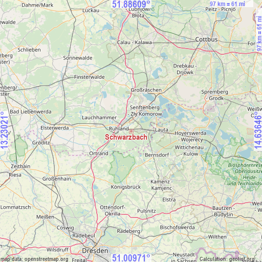
Schwarzbach GPS coordinates[2]
51° 27' 0" North, 13° 55' 59.988" East
| Map corner | latitude | longitude |
|---|---|---|
| Upper-left | 51.88609°, | 13.23021° |
| Center: | 51.45°, | 13.93333° |
| Lower-right: | 51.00971°, | 14.63646° |
| Map W x H: | 97.4×97.4 km | = 60.5×60.5mi |
| max Lat: | 55.01917° ⇑34.5% North |
| Schwarzbach: | 51.45° |
| min Lat: | ⇓65.5% South 47.40724° |
| min Long | Schwarzbach | max Long |
| 5.92978° | 13.93333° | 14.98853° |
| W 97.7%⇐ | ⇒2.3% E |
Elevation
Elevation of Schwarzbach is 101 m = 331 ft, and this is 148.1 m = 486 ft below average elevation for this country.
| Max E: |
1256 m = 4121 ft | 68.3% |
| Avg. | 249.1 m = 817 ft | |
| Schwarzbach | 101 m = 331 ft | |
Min E: |
-5 m = -16 ft | 31.7% |
See also: Germany elevation on elevation.city.
Geographical zone
Schwarzbach is located in North temperate zone (between Tropic of Cancer and the Arctic Circle). Distance of this North polar circle is 1680.5 km =1044.2 mi to North.| Distance of | km | miles | from Schwarzbach |
|---|---|---|---|
| North Pole | 4286.4 | 2663.4 | to North |
| Arctic Circle | 1680.5 | 1044.2 | to North |
| Tropic Cancer | 3114.8 | 1935.4 | to South |
| Equator | 5720.7 | 3554.7 | to South |


Nearby cities:
15 places around Schwarzbach: (largest is in red/bold)
• Bernsdorf
12.7 km =7.9 mi,  132°
132°
• Frauendorf
12 km =7.5 mi,  250°
250°
• Grünewald
7.2 km =4.5 mi,  140°
140°
• Guteborn
3.7 km =2.3 mi,  180°
180°
• Hermsdorf
5.7 km =3.5 mi,  209°
209°
• Hohenbocka
5.7 km =3.5 mi,  111°
111°
• Kroppen
11.9 km =7.4 mi,  231°
231°
• Lauchhammer
12.3 km =7.6 mi,  290°
290°
• Ruhland
4.7 km =2.9 mi,  280°
280°
• Schipkau
7.9 km =4.9 mi,  341°
341°
• Schwarzheide
6.1 km =3.8 mi,  298°
298°
• Schwepnitz
13.7 km =8.5 mi,  172°
172°
• Senftenberg
9.6 km =6 mi,  29°
29°
• Tettau
14 km =8.7 mi,  262°
262°
• Wiednitz
9.6 km =6 mi, 137°
Sources, notices
• [Note1] Compared only with cities in Germany existing in our database
• [Src1] Map data: © OpenStreetMap contributors (CC-BY-SA)
• [Src2] Other city data from geonames.org with taken over terms of usage.
• [Src3] Geographical zone / Annual Mean Temperature by Robert A. Rohde @ Wikipedia
