Fränkisch-Crumbach geodata
Fränkisch-Crumbach (Hesse) is a seat of a fourth-order administrative division; located in Germany in Europe/Berlin (GMT+2) time zone. With population of 3,353 people, there are 3719 cities with bigger population in this country. Compared to other cities in Germany, 70.3% of cities are located further ↑North; 67.2% of cities are located further →East and 54.6% of cities have higher elevation than Fränkisch-Crumbach. Note1
Administrative division(s):
- Level 1: Hesse
- Level 2: Regierungsbezirk Darmstadt
- Level 3: Odenwaldkreis
- Level 4: Fränkisch-Crumbach


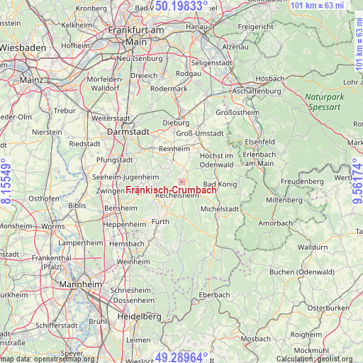
Fränkisch-Crumbach GPS coordinates[2]
49° 44' 45.996" North, 8° 51' 30.996" East
| Map corner | latitude | longitude |
|---|---|---|
| Upper-left | 50.19833°, | 8.15549° |
| Center: | 49.74611°, | 8.85861° |
| Lower-right: | 49.28964°, | 9.56174° |
| Map W x H: | 101×101 km | = 62.8×62.8mi |
| max Lat: | 55.01917° ⇑70.3% North |
| Fränkisch-Crumbach: | 49.74611° |
| min Lat: | ⇓29.7% South 47.40724° |
| min Long | Fränkisch-Crum | max Long |
| 5.92978° | 8.85861° | 14.98853° |
| W 32.8%⇐ | ⇒67.2% E |
Elevation
Elevation of Fränkisch-Crumbach is 192 m = 630 ft, and this is 57.1 m = 187 ft below average elevation for this country.
| Max E: |
1256 m = 4121 ft | 54.6% |
| Avg. | 249.1 m = 817 ft | |
| Fränkisch-Crumbach | 192 m = 630 ft | |
Min E: |
-5 m = -16 ft | 45.4% |
See also: Germany elevation on elevation.city.
Geographical zone
Fränkisch-Crumbach is located in North temperate zone (between Tropic of Cancer and the Arctic Circle). Distance of this North polar circle is 1869.9 km =1161.9 mi to North.| Distance of | km | miles | from Fränkisch-Crumbach |
|---|---|---|---|
| North Pole | 4475.8 | 2781.1 | to North |
| Arctic Circle | 1869.9 | 1161.9 | to North |
| Tropic Cancer | 2925.3 | 1817.7 | to South |
| Equator | 5531.2 | 3436.9 | to South |


Nearby cities:
15 places around Fränkisch-Crumbach: (largest is in red/bold)
• Bad König
10.7 km =6.6 mi,  91°
91°
• Brensbach
3.6 km =2.2 mi,  30°
30°
• Erbach
13.5 km =8.4 mi,  134°
134°
• Fürth
11.9 km =7.4 mi,  206°
206°
• Groß-Bieberau
6.5 km =4 mi,  337°
337°
• Groß-Umstadt
14.6 km =9.1 mi,  21°
21°
• Groß-Zimmern
14.4 km =8.9 mi,  351°
351°
• Höchst im Odenwald
11.7 km =7.3 mi,  59°
59°
• Lindenfels
8.9 km =5.5 mi,  218°
218°
• Lützelbach
6.6 km =4.1 mi,  266°
266°
• Michelstadt
13 km =8.1 mi, 126°
• Ober-Ramstadt
12.3 km =7.6 mi,  320°
320°
• Reichelsheim
4 km =2.5 mi,  200°
200°
• Reinheim
9.4 km =5.8 mi, 349°
• Roßdorf
14.4 km =8.9 mi,  331°
331°
Sources, notices
• [Note1] Compared only with cities in Germany existing in our database
• [Src1] Map data: © OpenStreetMap contributors (CC-BY-SA)
• [Src2] Other city data from geonames.org with taken over terms of usage.
• [Src3] Geographical zone / Annual Mean Temperature by Robert A. Rohde @ Wikipedia
