Lindenfels geodata
Lindenfels (Hesse) is a populated place; located in Germany in Europe/Berlin (GMT+2) time zone. With population of 5,456 people, there are 2647 cities with bigger population in this country. Compared to other cities in Germany, 71.7% of cities are located further ↑North; 68.2% of cities are located further →East and 68.3% of cities have lower elevation than Lindenfels. Note1
Administrative division(s):
- Level 1: Hesse
- Level 2: Regierungsbezirk Darmstadt
- Level 3: Landkreis Bergstraße
- Level 4: Lindenfels


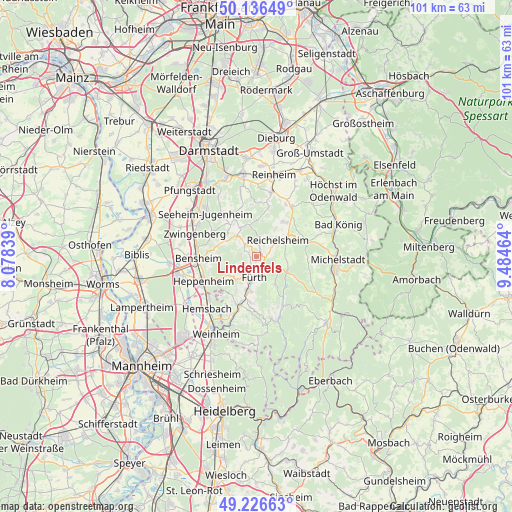
Lindenfels GPS coordinates[2]
49° 41' 1.284" North, 8° 46' 53.436" East
| Map corner | latitude | longitude |
|---|---|---|
| Upper-left | 50.13649°, | 8.07839° |
| Center: | 49.68369°, | 8.78151° |
| Lower-right: | 49.22663°, | 9.48464° |
| Map W x H: | 101.2×101.2 km | = 62.9×62.9mi |
| max Lat: | 55.01917° ⇑71.7% North |
| Lindenfels: | 49.68369° |
| min Lat: | ⇓28.3% South 47.40724° |
| min Long | Lindenfels | max Long |
| 5.92978° | 8.78151° | 14.98853° |
| W 31.8%⇐ | ⇒68.2% E |
Elevation
Elevation of Lindenfels is 345 m = 1132 ft, and this is 95.9 m = 315 ft above average elevation for this country.
| Max E: |
1256 m = 4121 ft | 31.7% |
| Lindenfels | 345 m 1132 ft | |
| Avg. | 249.1 m = 817 ft | |
Min E: |
-5 m = -16 ft | 68.3% |
See also: Germany elevation on elevation.city.
Geographical zone
Lindenfels is located in North temperate zone (between Tropic of Cancer and the Arctic Circle). Distance of this North polar circle is 1876.9 km =1166.3 mi to North.| Distance of | km | miles | from Lindenfels |
|---|---|---|---|
| North Pole | 4482.8 | 2785.5 | to North |
| Arctic Circle | 1876.9 | 1166.3 | to North |
| Tropic Cancer | 2918.4 | 1813.4 | to South |
| Equator | 5524.3 | 3432.6 | to South |


Nearby cities:
15 places around Lindenfels: (largest is in red/bold)
• Bensheim
11.7 km =7.3 mi,  270°
270°
• Brensbach
12.5 km =7.8 mi,  36°
36°
• Fränkisch-Crumbach
8.9 km =5.5 mi, 38°
• Fürth
3.7 km =2.3 mi,  176°
176°
• Groß-Bieberau
13.4 km =8.3 mi,  13°
13°
• Hemsbach
14.1 km =8.8 mi,  222°
222°
• Heppenheim an der Bergstrasse
11.7 km =7.3 mi,  246°
246°
• Laudenbach
12.1 km =7.5 mi,  229°
229°
• Lützelbach
6.6 km =4.1 mi,  350°
350°
• Mörlenbach
10 km =6.2 mi,  199°
199°
• Reichelsheim
5.2 km =3.2 mi,  52°
52°
• Rimbach
6.7 km =4.2 mi,  191°
191°
• Seeheim-Jugenheim
13 km =8.1 mi,  314°
314°
• Wald-Michelbach
13.1 km =8.1 mi,  164°
164°
• Zwingenberg
13.1 km =8.1 mi,  290°
290°
Sources, notices
• [Note1] Compared only with cities in Germany existing in our database
• [Src1] Map data: © OpenStreetMap contributors (CC-BY-SA)
• [Src2] Other city data from geonames.org with taken over terms of usage.
• [Src3] Geographical zone / Annual Mean Temperature by Robert A. Rohde @ Wikipedia
