Michelstadt geodata
Michelstadt (Hesse) is a populated place; located in Germany in Europe/Berlin (GMT+2) time zone. With population of 17,279 people, there are 923 cities with bigger population in this country. Compared to other cities in Germany, 71.9% of cities are located further ↑North; 65.4% of cities are located further →East and 52.6% of cities have higher elevation than Michelstadt. Note1
Administrative division(s):
- Level 1: Hesse
- Level 2: Regierungsbezirk Darmstadt
- Level 3: Odenwaldkreis
- Level 4: Michelstadt


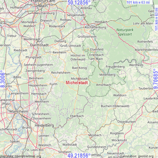
Michelstadt GPS coordinates[2]
49° 40' 32.484" North, 9° 0' 13.428" East
| Map corner | latitude | longitude |
|---|---|---|
| Upper-left | 50.12856°, | 8.3006° |
| Center: | 49.67569°, | 9.00373° |
| Lower-right: | 49.21856°, | 9.70685° |
| Map W x H: | 101.2×101.2 km | = 62.9×62.9mi |
| max Lat: | 55.01917° ⇑71.9% North |
| Michelstadt: | 49.67569° |
| min Lat: | ⇓28.1% South 47.40724° |
| min Long | Michelstadt | max Long |
| 5.92978° | 9.00373° | 14.98853° |
| W 34.6%⇐ | ⇒65.4% E |
Elevation
Elevation of Michelstadt is 207 m = 679 ft, and this is 42.1 m = 138 ft below average elevation for this country.
| Max E: |
1256 m = 4121 ft | 52.6% |
| Avg. | 249.1 m = 817 ft | |
| Michelstadt | 207 m = 679 ft | |
Min E: |
-5 m = -16 ft | 47.4% |
See also: Germany elevation on elevation.city.
Geographical zone
Michelstadt is located in North temperate zone (between Tropic of Cancer and the Arctic Circle). Distance of this North polar circle is 1877.8 km =1166.8 mi to North.| Distance of | km | miles | from Michelstadt |
|---|---|---|---|
| North Pole | 4483.6 | 2786 | to North |
| Arctic Circle | 1877.8 | 1166.8 | to North |
| Tropic Cancer | 2917.5 | 1812.8 | to South |
| Equator | 5523.4 | 3432.1 | to South |


Nearby cities:
15 places around Michelstadt: (largest is in red/bold)
• Bad König
7.5 km =4.7 mi,  2°
2°
• Beerfelden
12.1 km =7.5 mi,  190°
190°
• Brensbach
13.9 km =8.6 mi,  321°
321°
• Erbach
1.7 km =1.1 mi,  203°
203°
• Fränkisch-Crumbach
13 km =8.1 mi,  306°
306°
• Hesseneck
12.5 km =7.8 mi,  160°
160°
• Höchst im Odenwald
13.8 km =8.6 mi,  358°
358°
• Kirchzell
14.1 km =8.8 mi,  117°
117°
• Kleinheubach
15.9 km =9.9 mi,  71°
71°
• Laudenbach
14.6 km =9.1 mi,  57°
57°
• Lützelbach
13.5 km =8.4 mi,  22°
22°
• Reichelsheim
12.5 km =7.8 mi,  288°
288°
• Rüdenau
13.2 km =8.2 mi, 72°
• Weilbach
15.3 km =9.5 mi,  93°
93°
• Weiten-Gesäß
4.4 km =2.7 mi,  48°
48°
Sources, notices
• [Note1] Compared only with cities in Germany existing in our database
• [Src1] Map data: © OpenStreetMap contributors (CC-BY-SA)
• [Src2] Other city data from geonames.org with taken over terms of usage.
• [Src3] Geographical zone / Annual Mean Temperature by Robert A. Rohde @ Wikipedia
