Frankfurt (Oder) geodata
Frankfurt (Oder) (Brandenburg) is a populated place; located in Germany in Europe/Berlin (GMT+2) time zone. With population of 51,691 people, there are 213 cities with bigger population in this country. Compared to other cities in Germany, 75.7% of cities are located further ↓South; 99.4% of cities are located further ←West and 87.7% of cities have higher elevation than Frankfurt (Oder). Note1
Administrative division(s):
- Level 1: Brandenburg
- Level 3: Frankfurt (Oder)
- Level 4: Frankfurt (Oder)


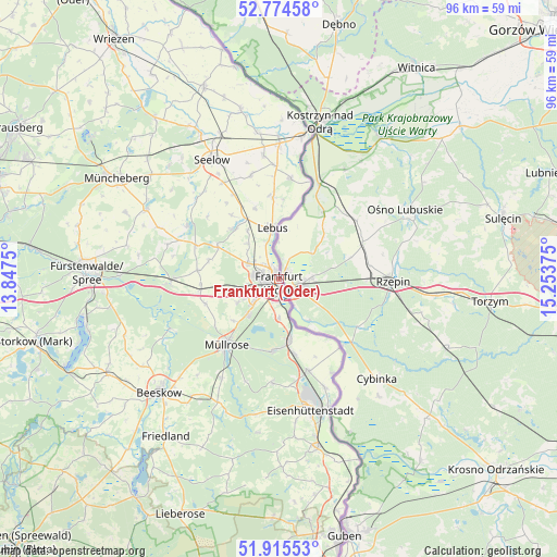
Frankfurt (Oder) GPS coordinates[2]
52° 20' 49.704" North, 14° 33' 2.232" East
| Map corner | latitude | longitude |
|---|---|---|
| Upper-left | 52.77458°, | 13.8475° |
| Center: | 52.34714°, | 14.55062° |
| Lower-right: | 51.91553°, | 15.25375° |
| Map W x H: | 95.5×95.5 km | = 59.3×59.3mi |
| max Lat: | 55.01917° ⇑24.3% North |
| Frankfurt (Oder): | 52.34714° |
| min Lat: | ⇓75.7% South 47.40724° |
| min Long | Frankfurt (Oder | max Long |
| 5.92978° | 14.55062° | 14.98853° |
| W 99.4%⇐ | ⇒0.59999999999999% E |
Elevation
Elevation of Frankfurt (Oder) is 28 m = 92 ft, and this is 221.1 m = 725 ft below average elevation for this country.
| Max E: |
1256 m = 4121 ft | 87.7% |
| Avg. | 249.1 m = 817 ft | |
| Frankfurt (Oder) | 28 m = 92 ft | |
Min E: |
-5 m = -16 ft | 12.3% |
See also: Frankfurt (Oder) elevation on elevation.city.
Geographical zone
Frankfurt (Oder) is located in North temperate zone (between Tropic of Cancer and the Arctic Circle). Distance of this North polar circle is 1580.7 km =982.2 mi to North.| Distance of | km | miles | from Frankfurt (Oder) |
|---|---|---|---|
| North Pole | 4186.6 | 2601.4 | to North |
| Arctic Circle | 1580.7 | 982.2 | to North |
| Tropic Cancer | 3214.5 | 1997.4 | to South |
| Equator | 5820.5 | 3616.7 | to South |


Nearby cities:
15 places around Frankfurt (Oder): (largest is in red/bold)
• Briesen
18.5 km =11.5 mi,  268°
268°
• Brieskow-Finkenheerd
10.5 km =6.5 mi,  171°
171°
• Falkenhagen
18.5 km =11.5 mi,  301°
301°
• Groß Lindow
12.7 km =7.9 mi,  185°
185°
• Jacobsdorf
13.7 km =8.5 mi,  263°
263°
• Lebus
9 km =5.6 mi,  352°
352°
• Lietzen
19.8 km =12.3 mi,  313°
313°
• Mixdorf
19.3 km =12 mi,  212°
212°
• Müllrose
14.3 km =8.9 mi,  219°
219°
• Podelzig
13.9 km =8.6 mi,  355°
355°
• Reitwein
17.2 km =10.7 mi,  7°
7°
• Treplin
11.8 km =7.3 mi, 299°
• Vogelsang
19.9 km =12.4 mi,  157°
157°
• Wiesenau
13.2 km =8.2 mi, 168°
• Ziltendorf
16.5 km =10.3 mi, 162°
In other languages:
- In Spanish: Fráncfort del Óder
- In France: Francfort-sur-l'Oder
- In Italian: Francoforte sull'Oder
- In Russian: Франкфурт-на-Одере
Sources, notices
• [Note1] Compared only with cities in Germany existing in our database
• [Src1] Map data: © OpenStreetMap contributors (CC-BY-SA)
• [Src2] Other city data from geonames.org with taken over terms of usage.
• [Src3] Geographical zone / Annual Mean Temperature by Robert A. Rohde @ Wikipedia
