Falkenhagen geodata
Falkenhagen (Brandenburg) is a seat of a fourth-order administrative division; located in Germany in Europe/Berlin (GMT+2) time zone. With population of 742 people, there are 8140 cities with bigger population in this country. Compared to other cities in Germany, 76.6% of cities are located further ↓South; 98.9% of cities are located further ←West and 75% of cities have higher elevation than Falkenhagen. Note1
Administrative division(s):
- Level 1: Brandenburg
- Level 3: Landkreis Märkisch-Oderland
- Level 4: Falkenhagen


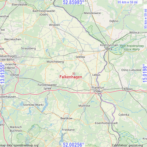
Falkenhagen GPS coordinates[2]
52° 25' 59.988" North, 14° 19' 0.012" East
| Map corner | latitude | longitude |
|---|---|---|
| Upper-left | 52.85993°, | 13.61355° |
| Center: | 52.43333°, | 14.31667° |
| Lower-right: | 52.00256°, | 15.0198° |
| Map W x H: | 95.3×95.3 km | = 59.2×59.2mi |
| max Lat: | 55.01917° ⇑23.4% North |
| Falkenhagen: | 52.43333° |
| min Lat: | ⇓76.6% South 47.40724° |
| min Long | Falkenhagen | max Long |
| 5.92978° | 14.31667° | 14.98853° |
| W 98.9%⇐ | ⇒1.1% E |
Elevation
Elevation of Falkenhagen is 63 m = 207 ft, and this is 186.1 m = 611 ft below average elevation for this country.
| Max E: |
1256 m = 4121 ft | 75% |
| Avg. | 249.1 m = 817 ft | |
| Falkenhagen | 63 m = 207 ft | |
Min E: |
-5 m = -16 ft | 25% |
See also: Germany elevation on elevation.city.
Geographical zone
Falkenhagen is located in North temperate zone (between Tropic of Cancer and the Arctic Circle). Distance of this North polar circle is 1571.1 km =976.2 mi to North.| Distance of | km | miles | from Falkenhagen |
|---|---|---|---|
| North Pole | 4177 | 2595.5 | to North |
| Arctic Circle | 1571.1 | 976.2 | to North |
| Tropic Cancer | 3224.1 | 2003.4 | to South |
| Equator | 5830 | 3622.6 | to South |


Nearby cities:
15 places around Falkenhagen: (largest is in red/bold)
• Alt Tucheband
17.6 km =10.9 mi,  48°
48°
• Berkenbrück
14.6 km =9.1 mi,  230°
230°
• Briesen
10.3 km =6.4 mi,  194°
194°
• Frankfurt (Oder)
18.5 km =11.5 mi,  121°
121°
• Fürstenwalde
19.1 km =11.9 mi,  244°
244°
• Jacobsdorf
11.3 km =7 mi,  168°
168°
• Langewahl
18.4 km =11.4 mi, 232°
• Lebus
14.6 km =9.1 mi,  92°
92°
• Lietzen
4.4 km =2.7 mi,  21°
21°
• Müncheberg
14.7 km =9.1 mi,  303°
303°
• Neuhardenberg
18.9 km =11.7 mi,  343°
343°
• Podelzig
15.4 km =9.6 mi,  73°
73°
• Seelow
12 km =7.5 mi, 21°
• Steinhöfel
10.8 km =6.7 mi,  249°
249°
• Treplin
6.8 km =4.2 mi, 123°
Sources, notices
• [Note1] Compared only with cities in Germany existing in our database
• [Src1] Map data: © OpenStreetMap contributors (CC-BY-SA)
• [Src2] Other city data from geonames.org with taken over terms of usage.
• [Src3] Geographical zone / Annual Mean Temperature by Robert A. Rohde @ Wikipedia
