Vogelsang geodata
Vogelsang (Brandenburg) is a seat of a fourth-order administrative division; located in Germany in Europe/Berlin (GMT+2) time zone. With population of 798 people, there are 7909 cities with bigger population in this country. Compared to other cities in Germany, 73.8% of cities are located further ↓South; 99.7% of cities are located further ←West and 87.7% of cities have higher elevation than Vogelsang. Note1


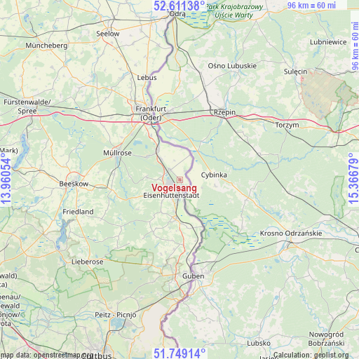
Vogelsang GPS coordinates[2]
52° 10' 56.46" North, 14° 39' 49.176" East
| Map corner | latitude | longitude |
|---|---|---|
| Upper-left | 52.61138°, | 13.96054° |
| Center: | 52.18235°, | 14.66366° |
| Lower-right: | 51.74914°, | 15.36679° |
| Map W x H: | 95.9×95.9 km | = 59.6×59.6mi |
| max Lat: | 55.01917° ⇑26.2% North |
| Vogelsang: | 52.18235° |
| min Lat: | ⇓73.8% South 47.40724° |
| min Long | Vogelsang | max Long |
| 5.92978° | 14.66366° | 14.98853° |
| W 99.7%⇐ | ⇒0.3% E |
Elevation
Elevation of Vogelsang is 28 m = 92 ft, and this is 221.1 m = 725 ft below average elevation for this country.
| Max E: |
1256 m = 4121 ft | 87.7% |
| Avg. | 249.1 m = 817 ft | |
| Vogelsang | 28 m = 92 ft | |
Min E: |
-5 m = -16 ft | 12.3% |
See also: Germany elevation on elevation.city.
Geographical zone
Vogelsang is located in North temperate zone (between Tropic of Cancer and the Arctic Circle). Distance of this North polar circle is 1599 km =993.6 mi to North.| Distance of | km | miles | from Vogelsang |
|---|---|---|---|
| North Pole | 4204.9 | 2612.8 | to North |
| Arctic Circle | 1599 | 993.6 | to North |
| Tropic Cancer | 3196.2 | 1986 | to South |
| Equator | 5802.1 | 3605.3 | to South |


Nearby cities:
15 places around Vogelsang: (largest is in red/bold)
• Beeskow
28.5 km =17.7 mi,  267°
267°
• Brieskow-Finkenheerd
10.1 km =6.3 mi,  322°
322°
• Eisenhüttenstadt
3.7 km =2.3 mi,  194°
194°
• Frankfurt (Oder)
19.9 km =12.4 mi,  337°
337°
• Friedland
28.6 km =17.8 mi,  252°
252°
• Groß Lindow
10.5 km =6.5 mi,  302°
302°
• Guben
26.1 km =16.2 mi,  172°
172°
• Jacobsdorf
27.2 km =16.9 mi,  308°
308°
• Lawitz
8.5 km =5.3 mi, 190°
• Mixdorf
18.1 km =11.2 mi,  276°
276°
• Müllrose
18.2 km =11.3 mi,  293°
293°
• Neuzelle
10.3 km =6.4 mi, 185°
• Schenkendöbern
25.1 km =15.6 mi,  184°
184°
• Wiesenau
7.3 km =4.5 mi, 317°
• Ziltendorf
3.8 km =2.4 mi, 314°
Sources, notices
• [Note1] Compared only with cities in Germany existing in our database
• [Src1] Map data: © OpenStreetMap contributors (CC-BY-SA)
• [Src2] Other city data from geonames.org with taken over terms of usage.
• [Src3] Geographical zone / Annual Mean Temperature by Robert A. Rohde @ Wikipedia
