Eystrup geodata
Eystrup (Lower Saxony) is a seat of a fourth-order administrative division; located in Germany in Europe/Berlin (GMT+2) time zone. With population of 3,394 people, there are 3692 cities with bigger population in this country. Compared to other cities in Germany, 80.2% of cities are located further ↓South; 62.1% of cities are located further →East and 89.7% of cities have higher elevation than Eystrup. Note1
Administrative division(s):
- Level 1: Lower Saxony
- Level 3: Landkreis Nienburg/Weser
- Level 4: Eystrup


Eystrup GPS coordinates[2]
52° 46' 45.66" North, 9° 12' 47.34" East
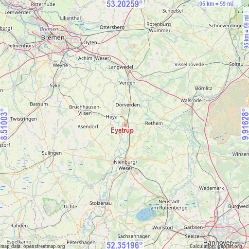
| Map corner | latitude | longitude |
|---|---|---|
| Upper-left | 53.20259°, | 8.51003° |
| Center: | 52.77935°, | 9.21315° |
| Lower-right: | 52.35196°, | 9.91628° |
| Map W x H: | 94.6×94.6 km | = 58.8×58.8mi |
| max Lat: | 55.01917° ⇑19.8% North |
| Eystrup: | 52.77935° |
| min Lat: | ⇓80.2% South 47.40724° |
| min Long | Eystrup | max Long |
| 5.92978° | 9.21315° | 14.98853° |
| W 37.9%⇐ | ⇒62.1% E |
Elevation
Elevation of Eystrup is 22 m = 72 ft, and this is 227.1 m = 745 ft below average elevation for this country.
| Max E: |
1256 m = 4121 ft | 89.7% |
| Avg. | 249.1 m = 817 ft | |
| Eystrup | 22 m = 72 ft | |
Min E: |
-5 m = -16 ft | 10.3% |
See also: Germany elevation on elevation.city.
Geographical zone
Eystrup is located in North temperate zone (between Tropic of Cancer and the Arctic Circle). Distance of this North polar circle is 1532.7 km =952.4 mi to North.| Distance of | km | miles | from Eystrup |
|---|---|---|---|
| North Pole | 4138.5 | 2571.5 | to North |
| Arctic Circle | 1532.7 | 952.4 | to North |
| Tropic Cancer | 3262.6 | 2027.3 | to South |
| Equator | 5868.5 | 3646.5 | to South |


Nearby cities:
15 places around Eystrup: (largest is in red/bold)
• Balge
7.6 km =4.7 mi,  204°
204°
• Bücken
5.3 km =3.3 mi,  269°
269°
• Drakenburg
10.3 km =6.4 mi,  180°
180°
• Dörverden
8 km =5 mi,  9°
9°
• Gandesbergen
2.3 km =1.4 mi,  158°
158°
• Haßbergen
5.3 km =3.3 mi,  165°
165°
• Heemsen
9.5 km =5.9 mi, 157°
• Hilgermissen
8.5 km =5.3 mi,  338°
338°
• Hoya
5.8 km =3.6 mi,  302°
302°
• Hoyerhagen
10.6 km =6.6 mi, 304°
• Hämelhausen
4.7 km =2.9 mi,  87°
87°
• Rethem
11.2 km =7 mi, 86°
• Röhrsen
7.7 km =4.8 mi, 170°
• Schweringen
3.8 km =2.4 mi,  211°
211°
• Warpe
9.2 km =5.7 mi,  236°
236°
Sources, notices
• [Note1] Compared only with cities in Germany existing in our database
• [Src1] Map data: © OpenStreetMap contributors (CC-BY-SA)
• [Src2] Other city data from geonames.org with taken over terms of usage.
• [Src3] Geographical zone / Annual Mean Temperature by Robert A. Rohde @ Wikipedia
