Rethem geodata
Rethem (Lower Saxony) is a populated place; located in Germany in Europe/Berlin (GMT+2) time zone. With population of 2,478 people, there are 4467 cities with bigger population in this country. Compared to other cities in Germany, 80.3% of cities are located further ↓South; 59.6% of cities are located further →East and 90.9% of cities have higher elevation than Rethem. Note1
Administrative division(s):
- Level 1: Lower Saxony
- Level 3: Landkreis Heidekreis
- Level 4: Rethem (Aller)


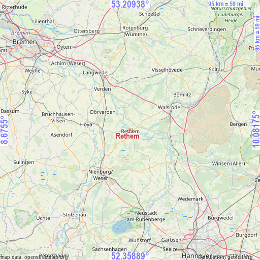
Rethem GPS coordinates[2]
52° 47' 10.356" North, 9° 22' 43.032" East
| Map corner | latitude | longitude |
|---|---|---|
| Upper-left | 53.20938°, | 8.6755° |
| Center: | 52.78621°, | 9.37862° |
| Lower-right: | 52.35889°, | 10.08175° |
| Map W x H: | 94.6×94.6 km | = 58.8×58.8mi |
| max Lat: | 55.01917° ⇑19.7% North |
| Rethem: | 52.78621° |
| min Lat: | ⇓80.3% South 47.40724° |
| min Long | Rethem | max Long |
| 5.92978° | 9.37862° | 14.98853° |
| W 40.4%⇐ | ⇒59.6% E |
Elevation
Elevation of Rethem is 19 m = 62 ft, and this is 230.1 m = 755 ft below average elevation for this country.
| Max E: |
1256 m = 4121 ft | 90.9% |
| Avg. | 249.1 m = 817 ft | |
| Rethem | 19 m = 62 ft | |
Min E: |
-5 m = -16 ft | 9.1% |
See also: Germany elevation on elevation.city.
Geographical zone
Rethem is located in North temperate zone (between Tropic of Cancer and the Arctic Circle). Distance of this North polar circle is 1531.9 km =951.9 mi to North.| Distance of | km | miles | from Rethem |
|---|---|---|---|
| North Pole | 4137.8 | 2571.1 | to North |
| Arctic Circle | 1531.9 | 951.9 | to North |
| Tropic Cancer | 3263.4 | 2027.8 | to South |
| Equator | 5869.3 | 3647 | to South |


Nearby cities:
15 places around Rethem: (largest is in red/bold)
• Ahlden
12 km =7.5 mi,  104°
104°
• Böhme
5.9 km =3.7 mi,  93°
93°
• Dörverden
12.1 km =7.5 mi,  305°
305°
• Eystrup
11.2 km =7 mi,  266°
266°
• Frankenfeld
4 km =2.5 mi,  119°
119°
• Gandesbergen
10.7 km =6.6 mi,  254°
254°
• Grethem
14.6 km =9.1 mi, 116°
• Haßbergen
11.4 km =7.1 mi,  238°
238°
• Heemsen
12.2 km =7.6 mi,  218°
218°
• Hodenhagen
14.7 km =9.1 mi, 99°
• Hämelhausen
6.5 km =4 mi,  264°
264°
• Häuslingen
2.8 km =1.7 mi,  19°
19°
• Röhrsen
13 km =8.1 mi,  229°
229°
• Schweringen
13.7 km =8.5 mi, 252°
• Steimbke
14.6 km =9.1 mi,  176°
176°
Sources, notices
• [Note1] Compared only with cities in Germany existing in our database
• [Src1] Map data: © OpenStreetMap contributors (CC-BY-SA)
• [Src2] Other city data from geonames.org with taken over terms of usage.
• [Src3] Geographical zone / Annual Mean Temperature by Robert A. Rohde @ Wikipedia
