Eriskirch geodata
Eriskirch (Baden-Württemberg) is a seat of a fourth-order administrative division; located in Germany in Europe/Berlin (GMT+2) time zone. With population of 4,319 people, there are 3124 cities with bigger population in this country. Compared to other cities in Germany, 99.4% of cities are located further ↑North; 57.1% of cities are located further →East and 76.8% of cities have lower elevation than Eriskirch. Note1
Administrative division(s):
- Level 1: Baden-Württemberg
- Level 2: Tübingen Region
- Level 3: Bodenseekreis
- Level 4: Eriskirch


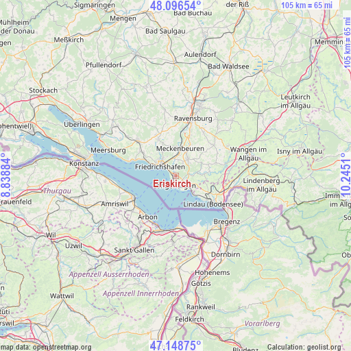
Eriskirch GPS coordinates[2]
47° 37' 29.244" North, 9° 32' 31.092" East
| Map corner | latitude | longitude |
|---|---|---|
| Upper-left | 48.09654°, | 8.83884° |
| Center: | 47.62479°, | 9.54197° |
| Lower-right: | 47.14875°, | 10.2451° |
| Map W x H: | 105.4×105.4 km | = 65.5×65.5mi |
| max Lat: | 55.01917° ⇑99.4% North |
| Eriskirch: | 47.62479° |
| min Lat: | ⇓0.6% South 47.40724° |
| min Long | Eriskirch | max Long |
| 5.92978° | 9.54197° | 14.98853° |
| W 42.9%⇐ | ⇒57.1% E |
Elevation
Elevation of Eriskirch is 411 m = 1348 ft, and this is 161.9 m = 531 ft above average elevation for this country.
| Max E: |
1256 m = 4121 ft | 23.2% |
| Eriskirch | 411 m 1348 ft | |
| Avg. | 249.1 m = 817 ft | |
Min E: |
-5 m = -16 ft | 76.8% |
See also: Germany elevation on elevation.city.
Geographical zone
Eriskirch is located in North temperate zone (between Tropic of Cancer and the Arctic Circle). Distance of this North polar circle is 2105.8 km =1308.5 mi to North.| Distance of | km | miles | from Eriskirch |
|---|---|---|---|
| North Pole | 4711.7 | 2927.7 | to North |
| Arctic Circle | 2105.8 | 1308.5 | to North |
| Tropic Cancer | 2689.5 | 1671.2 | to South |
| Equator | 5295.4 | 3290.4 | to South |


Nearby cities:
15 places around Eriskirch: (largest is in red/bold)
• Bodnegg
14.5 km =9 mi,  49°
49°
• Bodolz
11.4 km =7.1 mi,  124°
124°
• Friedrichshafen
6.1 km =3.8 mi,  305°
305°
• Grünkraut
15.8 km =9.8 mi,  32°
32°
• Immenstaad am Bodensee
13.9 km =8.6 mi,  289°
289°
• Kressbronn am Bodensee
5.1 km =3.2 mi,  126°
126°
• Langenargen
2.9 km =1.8 mi,  180°
180°
• Lindau
13.8 km =8.6 mi, 129°
• Markdorf
15.5 km =9.6 mi, 312°
• Meckenbeuren
8.6 km =5.3 mi,  12°
12°
• Neukirch
12.6 km =7.8 mi,  73°
73°
• Nonnenhorn
7.6 km =4.7 mi,  137°
137°
• Oberteuringen
12.3 km =7.6 mi,  333°
333°
• Tettnang
6.1 km =3.8 mi,  37°
37°
• Weißensberg
14.6 km =9.1 mi,  109°
109°
Sources, notices
• [Note1] Compared only with cities in Germany existing in our database
• [Src1] Map data: © OpenStreetMap contributors (CC-BY-SA)
• [Src2] Other city data from geonames.org with taken over terms of usage.
• [Src3] Geographical zone / Annual Mean Temperature by Robert A. Rohde @ Wikipedia
