Immenstaad am Bodensee geodata
Immenstaad am Bodensee (Baden-Württemberg) is a seat of a fourth-order administrative division; located in Germany in Europe/Berlin (GMT+2) time zone. With population of 5,946 people, there are 2478 cities with bigger population in this country. Compared to other cities in Germany, 99.1% of cities are located further ↑North; 59.9% of cities are located further →East and 76.4% of cities have lower elevation than Immenstaad am Bodensee. Note1
Administrative division(s):
- Level 1: Baden-Württemberg
- Level 2: Tübingen Region
- Level 3: Bodenseekreis
- Level 4: Immenstaad am Bodensee
Current local time in Immenstaad am Bodensee:
01:09 PM, TuesdayDifference from your time zone: hours


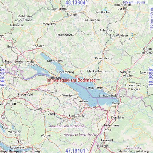
Immenstaad am Bodensee GPS coordinates[2]
47° 40' 0.012" North, 9° 22' 0.012" East
| Map corner | latitude | longitude |
|---|---|---|
| Upper-left | 48.13804°, | 8.66355° |
| Center: | 47.66667°, | 9.36667° |
| Lower-right: | 47.19101°, | 10.0698° |
| Map W x H: | 105.3×105.3 km | = 65.4×65.4mi |
| max Lat: | 55.01917° ⇑99.1% North |
| Immenstaad am Bodensee: | 47.66667° |
| min Lat: | ⇓0.9% South 47.40724° |
| min Long | Immenstaad am B | max Long |
| 5.92978° | 9.36667° | 14.98853° |
| W 40.1%⇐ | ⇒59.9% E |
Elevation
Elevation of Immenstaad am Bodensee is 408 m = 1339 ft, and this is 158.9 m = 521 ft above average elevation for this country.
| Max E: |
1256 m = 4121 ft | 23.6% |
| Immenstaad am Bodensee | 408 m 1339 ft | |
| Avg. | 249.1 m = 817 ft | |
Min E: |
-5 m = -16 ft | 76.4% |
See also: Germany elevation on elevation.city.
Geographical zone
Immenstaad am Bodensee is located in North temperate zone (between Tropic of Cancer and the Arctic Circle). Distance of this North polar circle is 2101.1 km =1305.6 mi to North.| Distance of | km | miles | from Immenstaad am Bodensee |
|---|---|---|---|
| North Pole | 4707 | 2924.8 | to North |
| Arctic Circle | 2101.1 | 1305.6 | to North |
| Tropic Cancer | 2694.1 | 1674 | to South |
| Equator | 5300 | 3293.3 | to South |


Nearby cities:
15 places around Immenstaad am Bodensee: (largest is in red/bold)
• Bermatingen
7.5 km =4.7 mi,  350°
350°
• Daisendorf
9 km =5.6 mi,  304°
304°
• Eriskirch
13.9 km =8.6 mi,  109°
109°
• Friedrichshafen
8.2 km =5.1 mi,  97°
97°
• Fürstenberg
15.9 km =9.9 mi,  274°
274°
• Hagnau
3.8 km =2.4 mi,  286°
286°
• Konstanz
14.3 km =8.9 mi, 267°
• Langenargen
15.1 km =9.4 mi,  120°
120°
• Markdorf
6.1 km =3.8 mi,  16°
16°
• Meckenbeuren
15.4 km =9.6 mi,  76°
76°
• Meersburg
7.8 km =4.8 mi, 293°
• Oberteuringen
10 km =6.2 mi,  50°
50°
• Salem
12.1 km =7.5 mi,  331°
331°
• Stetten
5.7 km =3.5 mi, 297°
• Uhldingen-Mühlhofen
11.5 km =7.1 mi,  310°
310°
Sources, notices
• [Note1] Compared only with cities in Germany existing in our database
• [Src1] Map data: © OpenStreetMap contributors (CC-BY-SA)
• [Src2] Other city data from geonames.org with taken over terms of usage.
• [Src3] Geographical zone / Annual Mean Temperature by Robert A. Rohde @ Wikipedia
