Friedrichshafen geodata
Friedrichshafen (Baden-Württemberg) is a seat of a third-order administrative division; located in Germany in Europe/Berlin (GMT+2) time zone. With population of 58,403 people, there are 184 cities with bigger population in this country. Compared to other cities in Germany, 99.1% of cities are located further ↑North; 58.2% of cities are located further →East and 75.9% of cities have lower elevation than Friedrichshafen. Note1
Administrative division(s):
- Level 1: Baden-Württemberg
- Level 2: Tübingen Region
- Level 3: Bodenseekreis
- Level 4: Friedrichshafen


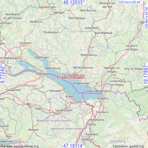
Friedrichshafen GPS coordinates[2]
47° 39' 24.804" North, 9° 28' 31.944" East
| Map corner | latitude | longitude |
|---|---|---|
| Upper-left | 48.12835°, | 8.77242° |
| Center: | 47.65689°, | 9.47554° |
| Lower-right: | 47.18114°, | 10.17867° |
| Map W x H: | 105.3×105.3 km | = 65.4×65.4mi |
| max Lat: | 55.01917° ⇑99.1% North |
| Friedrichshafen: | 47.65689° |
| min Lat: | ⇓0.9% South 47.40724° |
| min Long | Friedrichshafen | max Long |
| 5.92978° | 9.47554° | 14.98853° |
| W 41.8%⇐ | ⇒58.2% E |
Elevation
Elevation of Friedrichshafen is 405 m = 1329 ft, and this is 155.9 m = 511 ft above average elevation for this country.
| Max E: |
1256 m = 4121 ft | 24.1% |
| Friedrichshafen | 405 m 1329 ft | |
| Avg. | 249.1 m = 817 ft | |
Min E: |
-5 m = -16 ft | 75.9% |
See also: Friedrichshafen elevation on elevation.city.
Geographical zone
Friedrichshafen is located in North temperate zone (between Tropic of Cancer and the Arctic Circle). Distance of this North polar circle is 2102.2 km =1306.2 mi to North.| Distance of | km | miles | from Friedrichshafen |
|---|---|---|---|
| North Pole | 4708.1 | 2925.5 | to North |
| Arctic Circle | 2102.2 | 1306.2 | to North |
| Tropic Cancer | 2693 | 1673.4 | to South |
| Equator | 5298.9 | 3292.6 | to South |


Nearby cities:
15 places around Friedrichshafen: (largest is in red/bold)
• Bermatingen
12.7 km =7.9 mi,  312°
312°
• Eriskirch
6.1 km =3.8 mi,  125°
125°
• Grünkraut
16.6 km =10.3 mi,  54°
54°
• Hagnau
12 km =7.5 mi,  280°
280°
• Horgenzell
16.6 km =10.3 mi,  5°
5°
• Immenstaad am Bodensee
8.2 km =5.1 mi, 277°
• Kressbronn am Bodensee
11.2 km =7 mi, 125°
• Langenargen
8.2 km =5.1 mi,  142°
142°
• Markdorf
9.4 km =5.8 mi,  317°
317°
• Meckenbeuren
8.3 km =5.2 mi, 54°
• Meersburg
15.9 km =9.9 mi,  285°
285°
• Nonnenhorn
13.7 km =8.5 mi, 132°
• Oberteuringen
7.5 km =4.7 mi,  356°
356°
• Stetten
13.8 km =8.6 mi, 285°
• Tettnang
8.8 km =5.5 mi,  81°
81°
Sources, notices
• [Note1] Compared only with cities in Germany existing in our database
• [Src1] Map data: © OpenStreetMap contributors (CC-BY-SA)
• [Src2] Other city data from geonames.org with taken over terms of usage.
• [Src3] Geographical zone / Annual Mean Temperature by Robert A. Rohde @ Wikipedia
