Eppishausen geodata
Eppishausen (Bavaria) is a seat of a fourth-order administrative division; located in Germany in Europe/Berlin (GMT+2) time zone. With population of 1,822 people, there are 5310 cities with bigger population in this country. Compared to other cities in Germany, 93.2% of cities are located further ↑North; 59.1% of cities are located further ←West and 92.7% of cities have lower elevation than Eppishausen. Note1
Administrative division(s):
- Level 1: Bavaria
- Level 2: Swabia
- Level 3: Landkreis Unterallgäu
- Level 4: Eppishausen


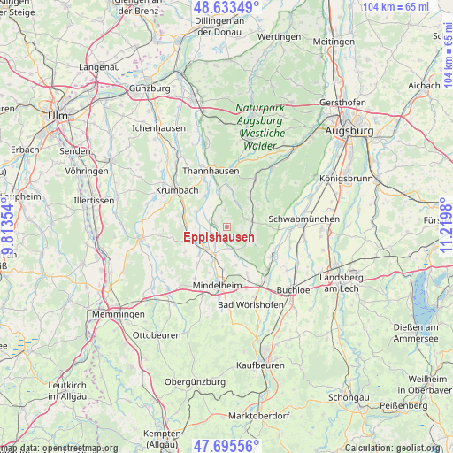
Eppishausen GPS coordinates[2]
48° 10' 0.012" North, 10° 31' 0.012" East
| Map corner | latitude | longitude |
|---|---|---|
| Upper-left | 48.63349°, | 9.81354° |
| Center: | 48.16667°, | 10.51667° |
| Lower-right: | 47.69556°, | 11.2198° |
| Map W x H: | 104.3×104.3 km | = 64.8×64.8mi |
| max Lat: | 55.01917° ⇑93.2% North |
| Eppishausen: | 48.16667° |
| min Lat: | ⇓6.8% South 47.40724° |
| min Long | Eppishausen | max Long |
| 5.92978° | 10.51667° | 14.98853° |
| W 59.1%⇐ | ⇒40.9% E |
Elevation
Elevation of Eppishausen is 553 m = 1814 ft, and this is 303.9 m = 997 ft above average elevation for this country.
| Max E: |
1256 m = 4121 ft | 7.3% |
| Eppishausen | 553 m 1814 ft | |
| Avg. | 249.1 m = 817 ft | |
Min E: |
-5 m = -16 ft | 92.7% |
See also: Germany elevation on elevation.city.
Geographical zone
Eppishausen is located in North temperate zone (between Tropic of Cancer and the Arctic Circle). Distance of this North polar circle is 2045.5 km =1271 mi to North.| Distance of | km | miles | from Eppishausen |
|---|---|---|---|
| North Pole | 4651.4 | 2890.2 | to North |
| Arctic Circle | 2045.5 | 1271 | to North |
| Tropic Cancer | 2749.7 | 1708.6 | to South |
| Equator | 5355.6 | 3327.8 | to South |


Nearby cities:
15 places around Eppishausen: (largest is in red/bold)
• Aichen
7.1 km =4.4 mi,  13°
13°
• Aletshausen
10.1 km =6.3 mi,  290°
290°
• Balzhausen
8.6 km =5.3 mi,  348°
348°
• Breitenbrunn
9.4 km =5.8 mi,  246°
246°
• Kirchheim
3.3 km =2.1 mi, 286°
• Markt Wald
5.9 km =3.7 mi,  124°
124°
• Mittelneufnach
6.1 km =3.8 mi,  79°
79°
• Münster
11.3 km =7 mi,  51°
51°
• Oberrieden
11 km =6.8 mi,  217°
217°
• Pfaffenhausen
7 km =4.3 mi, 220°
• Salgen
4.9 km =3 mi, 215°
• Scherstetten
9.3 km =5.8 mi, 80°
• Tussenhausen
7.9 km =4.9 mi,  155°
155°
• Walkertshofen
8.5 km =5.3 mi,  38°
38°
• Waltenhausen
11.6 km =7.2 mi,  283°
283°
Sources, notices
• [Note1] Compared only with cities in Germany existing in our database
• [Src1] Map data: © OpenStreetMap contributors (CC-BY-SA)
• [Src2] Other city data from geonames.org with taken over terms of usage.
• [Src3] Geographical zone / Annual Mean Temperature by Robert A. Rohde @ Wikipedia
