Eggersdorf geodata
Eggersdorf (Saxony-Anhalt) is a populated place; located in Germany in Europe/Berlin (GMT+2) time zone. With population of 1,224 people, there are 6505 cities with bigger population in this country. Compared to other cities in Germany, 71.9% of cities are located further ↓South; 77.4% of cities are located further ←West and 77.3% of cities have higher elevation than Eggersdorf. Note1


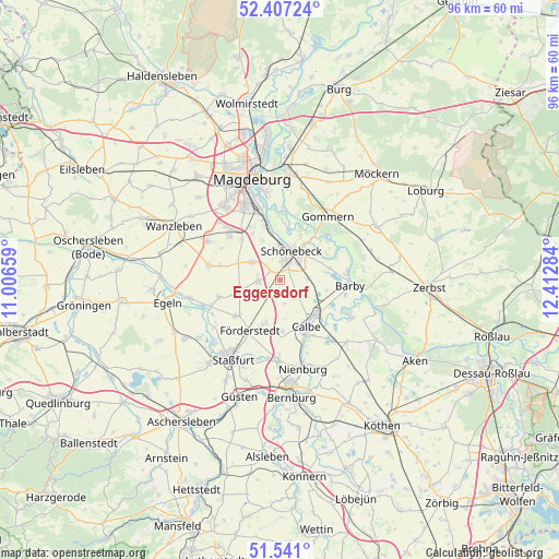
Eggersdorf GPS coordinates[2]
51° 58' 34.356" North, 11° 42' 34.956" East
| Map corner | latitude | longitude |
|---|---|---|
| Upper-left | 52.40724°, | 11.00659° |
| Center: | 51.97621°, | 11.70971° |
| Lower-right: | 51.541°, | 12.41284° |
| Map W x H: | 96.3×96.3 km | = 59.8×59.8mi |
| max Lat: | 55.01917° ⇑28.1% North |
| Eggersdorf: | 51.97621° |
| min Lat: | ⇓71.9% South 47.40724° |
| min Long | Eggersdorf | max Long |
| 5.92978° | 11.70971° | 14.98853° |
| W 77.4%⇐ | ⇒22.6% E |
Elevation
Elevation of Eggersdorf is 55 m = 180 ft, and this is 194.1 m = 637 ft below average elevation for this country.
| Max E: |
1256 m = 4121 ft | 77.3% |
| Avg. | 249.1 m = 817 ft | |
| Eggersdorf | 55 m = 180 ft | |
Min E: |
-5 m = -16 ft | 22.7% |
See also: Germany elevation on elevation.city.
Geographical zone
Eggersdorf is located in North temperate zone (between Tropic of Cancer and the Arctic Circle). Distance of this North polar circle is 1622 km =1007.9 mi to North.| Distance of | km | miles | from Eggersdorf |
|---|---|---|---|
| North Pole | 4227.8 | 2627 | to North |
| Arctic Circle | 1622 | 1007.9 | to North |
| Tropic Cancer | 3173.3 | 1971.8 | to South |
| Equator | 5779.2 | 3591 | to South |


Nearby cities:
15 places around Eggersdorf: (largest is in red/bold)
• Atzendorf
9.9 km =6.2 mi,  230°
230°
• Biere
3.8 km =2.4 mi,  266°
266°
• Borne
10.8 km =6.7 mi,  253°
253°
• Brumby
8.9 km =5.5 mi,  176°
176°
• Calbe
8.9 km =5.5 mi,  150°
150°
• Eickendorf
4 km =2.5 mi,  216°
216°
• Förderstedt
10.2 km =6.3 mi,  210°
210°
• Glöthe
7.7 km =4.8 mi,  198°
198°
• Gnadau
4.8 km =3 mi,  89°
89°
• Klein Mühlingen
4 km =2.5 mi,  142°
142°
• Plötzky
10.5 km =6.5 mi,  36°
36°
• Pömmelte
8.9 km =5.5 mi,  76°
76°
• Schönebeck
4.7 km =2.9 mi,  17°
17°
• Tornitz
10.8 km =6.7 mi,  118°
118°
• Welsleben
5.7 km =3.5 mi,  301°
301°
Sources, notices
• [Note1] Compared only with cities in Germany existing in our database
• [Src1] Map data: © OpenStreetMap contributors (CC-BY-SA)
• [Src2] Other city data from geonames.org with taken over terms of usage.
• [Src3] Geographical zone / Annual Mean Temperature by Robert A. Rohde @ Wikipedia
