Dornholzhausen geodata
Dornholzhausen (Rheinland-Pfalz) is a seat of a fourth-order administrative division; located in Germany in Europe/Berlin (GMT+2) time zone. With population of 214 people, there are 10408 cities with bigger population in this country. Compared to other cities in Germany, 57.3% of cities are located further ↑North; 81.1% of cities are located further →East and 62.5% of cities have lower elevation than Dornholzhausen. Note1
Administrative division(s):
- Level 1: Rheinland-Pfalz
- Level 3: Rhein-Lahn-Kreis
- Level 4: Dornholzhausen


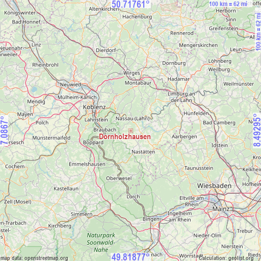
Dornholzhausen GPS coordinates[2]
50° 16' 13.116" North, 7° 47' 23.352" East
| Map corner | latitude | longitude |
|---|---|---|
| Upper-left | 50.71761°, | 7.0867° |
| Center: | 50.27031°, | 7.78982° |
| Lower-right: | 49.81877°, | 8.49295° |
| Map W x H: | 99.9×99.9 km | = 62.1×62.1mi |
| max Lat: | 55.01917° ⇑57.3% North |
| Dornholzhausen: | 50.27031° |
| min Lat: | ⇓42.7% South 47.40724° |
| min Long | Dornholzhausen | max Long |
| 5.92978° | 7.78982° | 14.98853° |
| W 18.9%⇐ | ⇒81.1% E |
Elevation
Elevation of Dornholzhausen is 305 m = 1001 ft, and this is 55.9 m = 183 ft above average elevation for this country.
| Max E: |
1256 m = 4121 ft | 37.5% |
| Dornholzhausen | 305 m 1001 ft | |
| Avg. | 249.1 m = 817 ft | |
Min E: |
-5 m = -16 ft | 62.5% |
See also: Germany elevation on elevation.city.
Geographical zone
Dornholzhausen is located in North temperate zone (between Tropic of Cancer and the Arctic Circle). Distance of this North polar circle is 1811.6 km =1125.7 mi to North.| Distance of | km | miles | from Dornholzhausen |
|---|---|---|---|
| North Pole | 4417.5 | 2744.9 | to North |
| Arctic Circle | 1811.6 | 1125.7 | to North |
| Tropic Cancer | 2983.6 | 1853.9 | to South |
| Equator | 5589.5 | 3473.2 | to South |


Nearby cities:
15 places around Dornholzhausen: (largest is in red/bold)
• Berg
2.4 km =1.5 mi,  139°
139°
• Dessighofen
1.9 km =1.2 mi,  222°
222°
• Dienethal
3.9 km =2.4 mi,  346°
346°
• Ehr
3.6 km =2.2 mi,  185°
185°
• Geisig
1.9 km =1.2 mi,  178°
178°
• Hunzel
4.1 km =2.5 mi,  125°
125°
• Kehlbach
2.5 km =1.6 mi,  240°
240°
• Marienfels
3.7 km =2.3 mi,  153°
153°
• Misselberg
4.3 km =2.7 mi,  340°
340°
• Niederbachheim
3 km =1.9 mi,  214°
214°
• Oberbachheim
4 km =2.5 mi,  228°
228°
• Oberwies
2.1 km =1.3 mi, 342°
• Schweighausen
3.2 km =2 mi,  297°
297°
• Singhofen
3.1 km =1.9 mi,  81°
81°
• Sulzbach
4.5 km =2.8 mi,  323°
323°
Sources, notices
• [Note1] Compared only with cities in Germany existing in our database
• [Src1] Map data: © OpenStreetMap contributors (CC-BY-SA)
• [Src2] Other city data from geonames.org with taken over terms of usage.
• [Src3] Geographical zone / Annual Mean Temperature by Robert A. Rohde @ Wikipedia
