Donsieders geodata
Donsieders (Rheinland-Pfalz) is a seat of a fourth-order administrative division; located in Germany in Europe/Berlin (GMT+2) time zone. With population of 994 people, there are 7207 cities with bigger population in this country. Compared to other cities in Germany, 79.3% of cities are located further ↑North; 84.1% of cities are located further →East and 71.6% of cities have lower elevation than Donsieders. Note1


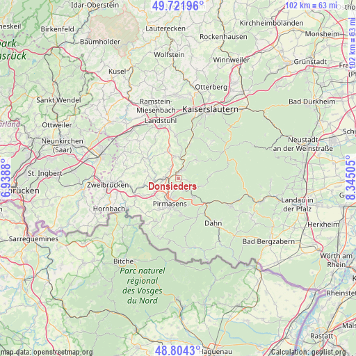
Donsieders GPS coordinates[2]
49° 15' 54.936" North, 7° 38' 30.912" East
| Map corner | latitude | longitude |
|---|---|---|
| Upper-left | 49.72196°, | 6.9388° |
| Center: | 49.26526°, | 7.64192° |
| Lower-right: | 48.8043°, | 8.34505° |
| Map W x H: | 102×102 km | = 63.4×63.4mi |
| max Lat: | 55.01917° ⇑79.3% North |
| Donsieders: | 49.26526° |
| min Lat: | ⇓20.7% South 47.40724° |
| min Long | Donsieders | max Long |
| 5.92978° | 7.64192° | 14.98853° |
| W 15.9%⇐ | ⇒84.1% E |
Elevation
Elevation of Donsieders is 371 m = 1217 ft, and this is 121.9 m = 400 ft above average elevation for this country.
| Max E: |
1256 m = 4121 ft | 28.4% |
| Donsieders | 371 m 1217 ft | |
| Avg. | 249.1 m = 817 ft | |
Min E: |
-5 m = -16 ft | 71.6% |
See also: Germany elevation on elevation.city.
Geographical zone
Donsieders is located in North temperate zone (between Tropic of Cancer and the Arctic Circle). Distance of this North polar circle is 1923.4 km =1195.1 mi to North.| Distance of | km | miles | from Donsieders |
|---|---|---|---|
| North Pole | 4529.3 | 2814.4 | to North |
| Arctic Circle | 1923.4 | 1195.1 | to North |
| Tropic Cancer | 2871.9 | 1784.5 | to South |
| Equator | 5477.8 | 3403.7 | to South |


Nearby cities:
15 places around Donsieders: (largest is in red/bold)
• Clausen
2.6 km =1.6 mi,  101°
101°
• Hermersberg
5.8 km =3.6 mi,  353°
353°
• Horbach
7.6 km =4.7 mi,  4°
4°
• Höheinöd
3.7 km =2.3 mi,  316°
316°
• Höheischweiler
7.6 km =4.7 mi,  241°
241°
• Höhfröschen
5.7 km =3.5 mi,  252°
252°
• Merzalben
6.8 km =4.2 mi,  109°
109°
• Münchweiler an der Rodalbe
6.9 km =4.3 mi,  139°
139°
• Petersberg
6.5 km =4 mi, 236°
• Pirmasens
7.6 km =4.7 mi,  200°
200°
• Rodalben
2.9 km =1.8 mi,  183°
183°
• Schauerberg
7.1 km =4.4 mi, 323°
• Steinalben
5.7 km =3.5 mi,  5°
5°
• Thaleischweiler-Fröschen
4.3 km =2.7 mi,  272°
272°
• Waldfischbach-Burgalben
2.7 km =1.7 mi,  41°
41°
Sources, notices
• [Note1] Compared only with cities in Germany existing in our database
• [Src1] Map data: © OpenStreetMap contributors (CC-BY-SA)
• [Src2] Other city data from geonames.org with taken over terms of usage.
• [Src3] Geographical zone / Annual Mean Temperature by Robert A. Rohde @ Wikipedia
