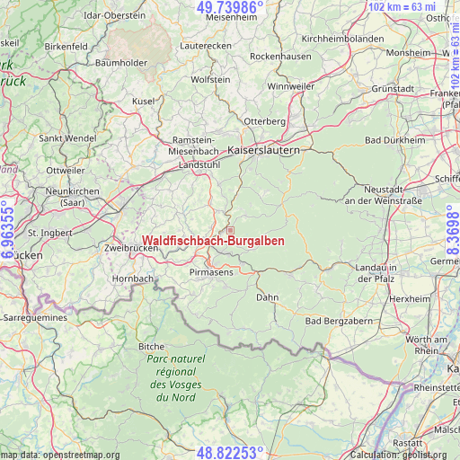
Waldfischbach-Burgalben geodata
Waldfischbach-Burgalben (Rheinland-Pfalz) is a seat of a fourth-order administrative division; located in Germany in Europe/Berlin (GMT+2) time zone. With population of 5,111 people, there are 2784 cities with bigger population in this country. Compared to other cities in Germany, 79% of cities are located further ↑North; 83.7% of cities are located further →East and 69.2% of cities have lower elevation than Waldfischbach-Burgalben. Note1
Administrative division(s):
- Level 1: Rheinland-Pfalz
- Level 3: Südwestpfalz
- Level 4: Waldfischbach-Burgalben
Current local time in Waldfischbach-Burgalben:
02:40 PM, TuesdayDifference from your time zone: hours


Waldfischbach-Burgalben GPS coordinates[2]
49° 16' 59.988" North, 7° 40' 0.012" East
| Map corner | latitude | longitude |
|---|---|---|
| Upper-left | 49.73986°, | 6.96355° |
| Center: | 49.28333°, | 7.66667° |
| Lower-right: | 48.82253°, | 8.3698° |
| Map W x H: | 102×102 km | = 63.4×63.4mi |
| max Lat: | 55.01917° ⇑79% North |
| Waldfischbach-Burgalben: | 49.28333° |
| min Lat: | ⇓21% South 47.40724° |
| min Long | Waldfischbach-B | max Long |
| 5.92978° | 7.66667° | 14.98853° |
| W 16.3%⇐ | ⇒83.7% E |
Elevation
Elevation of Waldfischbach-Burgalben is 352 m = 1155 ft, and this is 102.9 m = 338 ft above average elevation for this country.
| Max E: |
1256 m = 4121 ft | 30.8% |
| Waldfischbach-Burgalben | 352 m 1155 ft | |
| Avg. | 249.1 m = 817 ft | |
Min E: |
-5 m = -16 ft | 69.2% |
See also: Germany elevation on elevation.city.
Geographical zone
Waldfischbach-Burgalben is located in North temperate zone (between Tropic of Cancer and the Arctic Circle). Distance of this North polar circle is 1921.4 km =1193.9 mi to North.| Distance of | km | miles | from Waldfischbach-Burgalben |
|---|---|---|---|
| North Pole | 4527.3 | 2813.1 | to North |
| Arctic Circle | 1921.4 | 1193.9 | to North |
| Tropic Cancer | 2873.9 | 1785.8 | to South |
| Equator | 5479.8 | 3405 | to South |


Nearby cities:
15 places around Waldfischbach-Burgalben: (largest is in red/bold)
• Clausen
2.6 km =1.6 mi,  162°
162°
• Donsieders
2.7 km =1.7 mi,  221°
221°
• Geiselberg
5.2 km =3.2 mi,  24°
24°
• Heltersberg
5.2 km =3.2 mi,  44°
44°
• Hermersberg
4.4 km =2.7 mi,  326°
326°
• Horbach
5.7 km =3.5 mi,  347°
347°
• Höheinöd
4.4 km =2.7 mi,  279°
279°
• Merzalben
6.3 km =3.9 mi,  132°
132°
• Rodalben
5.3 km =3.3 mi,  201°
201°
• Schauerberg
7.1 km =4.4 mi,  301°
301°
• Schmalenberg
7.4 km =4.6 mi, 40°
• Schopp
7.5 km =4.7 mi,  9°
9°
• Steinalben
3.9 km =2.4 mi,  341°
341°
• Thaleischweiler-Fröschen
6.3 km =3.9 mi,  252°
252°
• Weselberg
7.3 km =4.5 mi,  324°
324°
Sources, notices
• [Note1] Compared only with cities in Germany existing in our database
• [Src1] Map data: © OpenStreetMap contributors (CC-BY-SA)
• [Src2] Other city data from geonames.org with taken over terms of usage.
• [Src3] Geographical zone / Annual Mean Temperature by Robert A. Rohde @ Wikipedia
