Dänischenhagen geodata
Dänischenhagen (Schleswig-Holstein) is a seat of a fourth-order administrative division; located in Germany in Europe/Berlin (GMT+2) time zone. With population of 3,402 people, there are 3687 cities with bigger population in this country. Compared to other cities in Germany, 97.6% of cities are located further ↓South; 52% of cities are located further ←West and 94.8% of cities have higher elevation than Dänischenhagen. Note1
Administrative division(s):
- Level 1: Schleswig-Holstein
- Level 3: Kreis Rendsburg-Eckernförde
- Level 4: Dänischenhagen


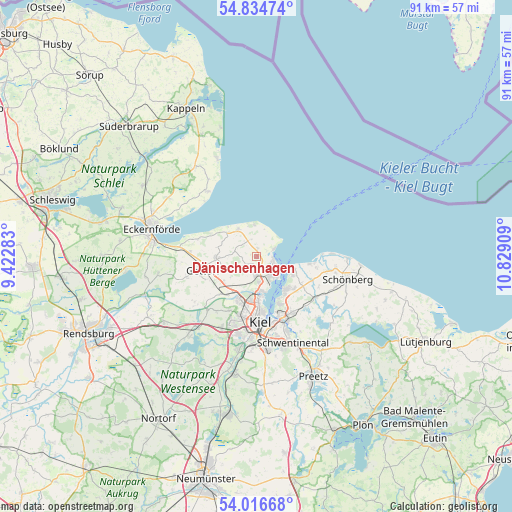
Dänischenhagen GPS coordinates[2]
54° 25' 39.9" North, 10° 7' 33.456" East
| Map corner | latitude | longitude |
|---|---|---|
| Upper-left | 54.83474°, | 9.42283° |
| Center: | 54.42775°, | 10.12596° |
| Lower-right: | 54.01668°, | 10.82909° |
| Map W x H: | 91×91 km | = 56.5×56.5mi |
| max Lat: | 55.01917° ⇑2.4% North |
| Dänischenhagen: | 54.42775° |
| min Lat: | ⇓97.6% South 47.40724° |
| min Long | Dänischenhagen | max Long |
| 5.92978° | 10.12596° | 14.98853° |
| W 52%⇐ | ⇒48% E |
Elevation
Elevation of Dänischenhagen is 9 m = 30 ft, and this is 240.1 m = 788 ft below average elevation for this country.
| Max E: |
1256 m = 4121 ft | 94.8% |
| Avg. | 249.1 m = 817 ft | |
| Dänischenhagen | 9 m = 30 ft | |
Min E: |
-5 m = -16 ft | 5.2% |
See also: Germany elevation on elevation.city.
Geographical zone
Dänischenhagen is located in North temperate zone (between Tropic of Cancer and the Arctic Circle). Distance of this North polar circle is 1349.4 km =838.5 mi to North.| Distance of | km | miles | from Dänischenhagen |
|---|---|---|---|
| North Pole | 3955.3 | 2457.7 | to North |
| Arctic Circle | 1349.4 | 838.5 | to North |
| Tropic Cancer | 3445.9 | 2141.2 | to South |
| Equator | 6051.8 | 3760.4 | to South |


Nearby cities:
15 places around Dänischenhagen: (largest is in red/bold)
• Altenholz
3.1 km =1.9 mi,  171°
171°
• Brodersdorf
9.4 km =5.8 mi,  121°
121°
• Felm
5.1 km =3.2 mi,  255°
255°
• Gettorf
9.7 km =6 mi,  251°
251°
• Heikendorf
8.3 km =5.2 mi,  144°
144°
• Laboe
6.6 km =4.1 mi, 117°
• Lutterbek
10.6 km =6.6 mi,  106°
106°
• Mönkeberg
9.4 km =5.8 mi,  156°
156°
• Neuwittenbek
9.8 km =6.1 mi,  226°
226°
• Noer
9.2 km =5.7 mi,  297°
297°
• Osdorf
7.1 km =4.4 mi,  275°
275°
• Stein
9.2 km =5.7 mi,  97°
97°
• Strande
2.7 km =1.7 mi,  76°
76°
• Tüttendorf
8.7 km =5.4 mi, 249°
• Wendtorf
10.7 km =6.6 mi, 99°
Sources, notices
• [Note1] Compared only with cities in Germany existing in our database
• [Src1] Map data: © OpenStreetMap contributors (CC-BY-SA)
• [Src2] Other city data from geonames.org with taken over terms of usage.
• [Src3] Geographical zone / Annual Mean Temperature by Robert A. Rohde @ Wikipedia
