Dahlem geodata
Dahlem (Lower Saxony) is a seat of a fourth-order administrative division; located in Germany in Europe/Berlin (GMT+2) time zone. With population of 543 people, there are 9125 cities with bigger population in this country. Compared to other cities in Germany, 82.9% of cities are located further ↓South; 63.2% of cities are located further ←West and 80.2% of cities have higher elevation than Dahlem. Note1


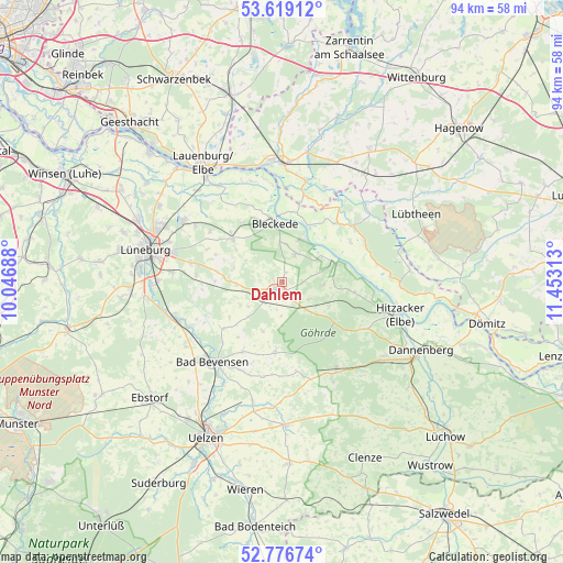
Dahlem GPS coordinates[2]
53° 12' 0" North, 10° 45' 0" East
| Map corner | latitude | longitude |
|---|---|---|
| Upper-left | 53.61912°, | 10.04688° |
| Center: | 53.2°, | 10.75° |
| Lower-right: | 52.77674°, | 11.45313° |
| Map W x H: | 93.7×93.7 km | = 58.2×58.2mi |
| max Lat: | 55.01917° ⇑17.1% North |
| Dahlem: | 53.2° |
| min Lat: | ⇓82.9% South 47.40724° |
| min Long | Dahlem | max Long |
| 5.92978° | 10.75° | 14.98853° |
| W 63.2%⇐ | ⇒36.8% E |
Elevation
Elevation of Dahlem is 46 m = 151 ft, and this is 203.1 m = 666 ft below average elevation for this country.
| Max E: |
1256 m = 4121 ft | 80.2% |
| Avg. | 249.1 m = 817 ft | |
| Dahlem | 46 m = 151 ft | |
Min E: |
-5 m = -16 ft | 19.8% |
See also: Germany elevation on elevation.city.
Geographical zone
Dahlem is located in North temperate zone (between Tropic of Cancer and the Arctic Circle). Distance of this North polar circle is 1485.9 km =923.3 mi to North.| Distance of | km | miles | from Dahlem |
|---|---|---|---|
| North Pole | 4091.8 | 2542.5 | to North |
| Arctic Circle | 1485.9 | 923.3 | to North |
| Tropic Cancer | 3309.4 | 2056.4 | to South |
| Equator | 5915.3 | 3675.6 | to South |


Nearby cities:
15 places around Dahlem: (largest is in red/bold)
• Altenmedingen
12.6 km =7.8 mi,  231°
231°
• Bleckede
10 km =6.2 mi,  353°
353°
• Boitze
5.6 km =3.5 mi,  180°
180°
• Dahlenburg
1.6 km =1 mi,  213°
213°
• Göhrde
10.5 km =6.5 mi,  122°
122°
• Himbergen
11.8 km =7.3 mi,  186°
186°
• Nahrendorf
5.1 km =3.2 mi, 124°
• Neetze
11.2 km =7 mi,  310°
310°
• Neu Darchau
9.6 km =6 mi,  70°
70°
• Reinstorf
12.4 km =7.7 mi,  288°
288°
• Römstedt
13 km =8.1 mi, 210°
• Stoetze
15 km =9.3 mi,  171°
171°
• Thomasburg
6.7 km =4.2 mi,  303°
303°
• Tosterglope
4.7 km =2.9 mi,  76°
76°
• Vastorf
13.6 km =8.5 mi,  269°
269°
Sources, notices
• [Note1] Compared only with cities in Germany existing in our database
• [Src1] Map data: © OpenStreetMap contributors (CC-BY-SA)
• [Src2] Other city data from geonames.org with taken over terms of usage.
• [Src3] Geographical zone / Annual Mean Temperature by Robert A. Rohde @ Wikipedia
