Crailsheim geodata
Crailsheim (Baden-Württemberg) is a populated place; located in Germany in Europe/Berlin (GMT+2) time zone. With population of 32,262 people, there are 427 cities with bigger population in this country. Compared to other cities in Germany, 81.3% of cities are located further ↑North; 51.3% of cities are located further ←West and 76.5% of cities have lower elevation than Crailsheim. Note1
Administrative division(s):
- Level 1: Baden-Württemberg
- Level 2: Regierungsbezirk Stuttgart
- Level 3: Landkreis Schwäbisch Hall
- Level 4: Crailsheim


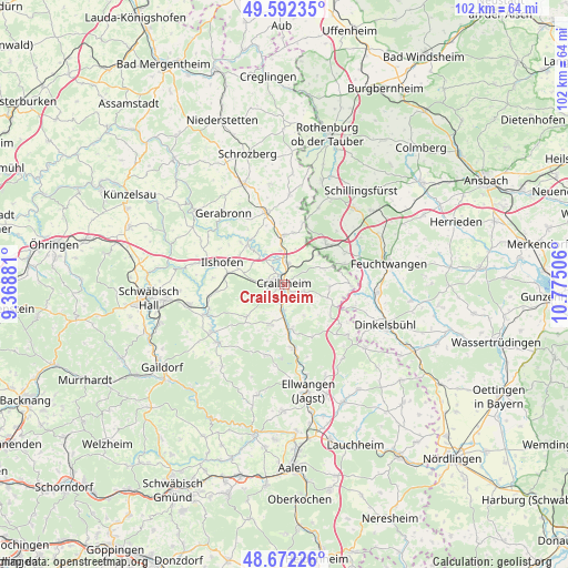
Crailsheim GPS coordinates[2]
49° 8' 3.984" North, 10° 4' 18.948" East
| Map corner | latitude | longitude |
|---|---|---|
| Upper-left | 49.59235°, | 9.36881° |
| Center: | 49.13444°, | 10.07193° |
| Lower-right: | 48.67226°, | 10.77506° |
| Map W x H: | 102.3×102.3 km | = 63.6×63.6mi |
| max Lat: | 55.01917° ⇑81.3% North |
| Crailsheim: | 49.13444° |
| min Lat: | ⇓18.7% South 47.40724° |
| min Long | Crailsheim | max Long |
| 5.92978° | 10.07193° | 14.98853° |
| W 51.3%⇐ | ⇒48.7% E |
Elevation
Elevation of Crailsheim is 409 m = 1342 ft, and this is 159.9 m = 525 ft above average elevation for this country.
| Max E: |
1256 m = 4121 ft | 23.5% |
| Crailsheim | 409 m 1342 ft | |
| Avg. | 249.1 m = 817 ft | |
Min E: |
-5 m = -16 ft | 76.5% |
See also: Germany elevation on elevation.city.
Geographical zone
Crailsheim is located in North temperate zone (between Tropic of Cancer and the Arctic Circle). Distance of this North polar circle is 1937.9 km =1204.2 mi to North.| Distance of | km | miles | from Crailsheim |
|---|---|---|---|
| North Pole | 4543.8 | 2823.4 | to North |
| Arctic Circle | 1937.9 | 1204.2 | to North |
| Tropic Cancer | 2857.3 | 1775.4 | to South |
| Equator | 5463.2 | 3394.7 | to South |


Nearby cities:
15 places around Crailsheim: (largest is in red/bold)
• Bühlertann
15.7 km =9.8 mi,  229°
229°
• Ellenberg
16.8 km =10.4 mi,  141°
141°
• Ilshofen
11.9 km =7.4 mi,  289°
289°
• Jagstzell
11.7 km =7.3 mi,  170°
170°
• Kirchberg an der Jagst
9.8 km =6.1 mi,  318°
318°
• Obersontheim
15.3 km =9.5 mi,  235°
235°
• Rosenberg
13.2 km =8.2 mi,  193°
193°
• Rot am See
13.5 km =8.4 mi,  342°
342°
• Satteldorf
3.9 km =2.4 mi,  8°
8°
• Schnelldorf
10.9 km =6.8 mi,  48°
48°
• Stimpfach
8.3 km =5.2 mi, 169°
• Vellberg
15.1 km =9.4 mi,  248°
248°
• Wallhausen
8.5 km =5.3 mi,  355°
355°
• Wettringen
15.1 km =9.4 mi,  24°
24°
• Wolpertshausen
16.9 km =10.5 mi,  282°
282°
Sources, notices
• [Note1] Compared only with cities in Germany existing in our database
• [Src1] Map data: © OpenStreetMap contributors (CC-BY-SA)
• [Src2] Other city data from geonames.org with taken over terms of usage.
• [Src3] Geographical zone / Annual Mean Temperature by Robert A. Rohde @ Wikipedia
