Büttel geodata
Büttel (Schleswig-Holstein) is a seat of a fourth-order administrative division; located in Germany in Europe/Berlin (GMT+2) time zone. With population of 48 people, there are 10967 cities with bigger population in this country. Compared to other cities in Germany, 91.2% of cities are located further ↓South; 61.8% of cities are located further →East and 99.9% of cities have higher elevation than Büttel. Note1


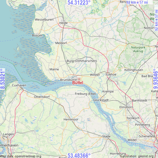
Büttel GPS coordinates[2]
53° 54' 0" North, 9° 13' 59.988" East
| Map corner | latitude | longitude |
|---|---|---|
| Upper-left | 54.31223°, | 8.53021° |
| Center: | 53.9°, | 9.23333° |
| Lower-right: | 53.48366°, | 9.93646° |
| Map W x H: | 92.1×92.1 km | = 57.2×57.2mi |
| max Lat: | 55.01917° ⇑8.8% North |
| Büttel: | 53.9° |
| min Lat: | ⇓91.2% South 47.40724° |
| min Long | Büttel | max Long |
| 5.92978° | 9.23333° | 14.98853° |
| W 38.2%⇐ | ⇒61.8% E |
Elevation
Elevation of Büttel is -3 m = -10 ft, and this is 252.1 m = 827 ft below average elevation for this country.
| Max E: |
1256 m = 4121 ft | 99.9% |
| Avg. | 249.1 m = 817 ft | |
| Büttel | -3 m = -10 ft | |
Min E: |
-5 m = -16 ft | 0.1% |
See also: Germany elevation on elevation.city.
Geographical zone
Büttel is located in North temperate zone (between Tropic of Cancer and the Arctic Circle). Distance of this North polar circle is 1408.1 km =875 mi to North.| Distance of | km | miles | from Büttel |
|---|---|---|---|
| North Pole | 4013.9 | 2494.1 | to North |
| Arctic Circle | 1408.1 | 875 | to North |
| Tropic Cancer | 3387.2 | 2104.7 | to South |
| Equator | 5993.1 | 3723.9 | to South |


Nearby cities:
15 places around Büttel: (largest is in red/bold)
• Aebtissinwisch
8.1 km =5 mi,  23°
23°
• Averlak
5.5 km =3.4 mi,  323°
323°
• Brokdorf
7.1 km =4.4 mi,  124°
124°
• Brunsbüttel
8.4 km =5.2 mi,  266°
266°
• Dammfleth
9.2 km =5.7 mi,  83°
83°
• Ecklak
6 km =3.7 mi, 21°
• Eddelak
7.8 km =4.8 mi, 315°
• Freiburg
9 km =5.6 mi,  156°
156°
• Krummendeich
7.9 km =4.9 mi,  194°
194°
• Kuden
8.1 km =5 mi,  336°
336°
• Kudensee
3.9 km =2.4 mi, 343°
• Landrecht
9.5 km =5.9 mi,  67°
67°
• Landscheide
2.6 km =1.6 mi,  29°
29°
• Sankt Margarethen
1.6 km =1 mi, 124°
• Wilster
9.6 km =6 mi, 74°
Sources, notices
• [Note1] Compared only with cities in Germany existing in our database
• [Src1] Map data: © OpenStreetMap contributors (CC-BY-SA)
• [Src2] Other city data from geonames.org with taken over terms of usage.
• [Src3] Geographical zone / Annual Mean Temperature by Robert A. Rohde @ Wikipedia
