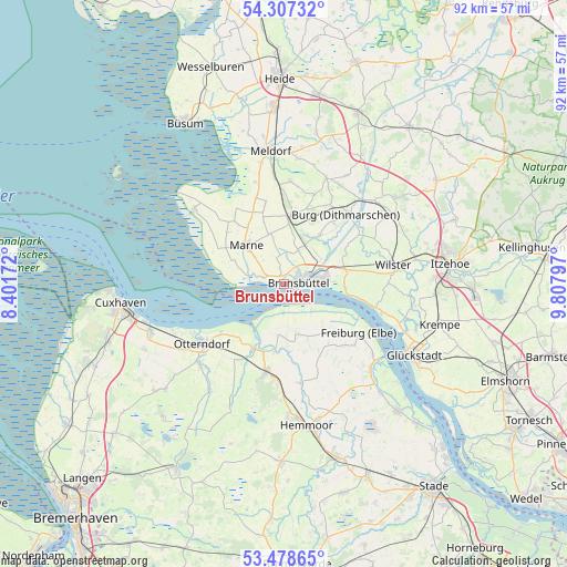
Brunsbüttel geodata
Brunsbüttel (Schleswig-Holstein) is a populated place; located in Germany in Europe/Berlin (GMT+2) time zone. With population of 13,950 people, there are 1143 cities with bigger population in this country. Compared to other cities in Germany, 91.1% of cities are located further ↓South; 63.9% of cities are located further →East and 98.6% of cities have higher elevation than Brunsbüttel. Note1
Administrative division(s):
- Level 1: Schleswig-Holstein
- Level 3: Kreis Dithmarschen
- Level 4: Brunsbüttel


Brunsbüttel GPS coordinates[2]
53° 53' 42.144" North, 9° 6' 17.424" East
| Map corner | latitude | longitude |
|---|---|---|
| Upper-left | 54.30732°, | 8.40172° |
| Center: | 53.89504°, | 9.10484° |
| Lower-right: | 53.47865°, | 9.80797° |
| Map W x H: | 92.1×92.1 km | = 57.2×57.2mi |
| max Lat: | 55.01917° ⇑8.9% North |
| Brunsbüttel: | 53.89504° |
| min Lat: | ⇓91.1% South 47.40724° |
| min Long | Brunsbüttel | max Long |
| 5.92978° | 9.10484° | 14.98853° |
| W 36.1%⇐ | ⇒63.9% E |
Elevation
Elevation of Brunsbüttel is 1 m = 3 ft, and this is 248.1 m = 814 ft below average elevation for this country.
| Max E: |
1256 m = 4121 ft | 98.6% |
| Avg. | 249.1 m = 817 ft | |
| Brunsbüttel | 1 m = 3 ft | |
Min E: |
-5 m = -16 ft | 1.4% |
See also: Germany elevation on elevation.city.
Geographical zone
Brunsbüttel is located in North temperate zone (between Tropic of Cancer and the Arctic Circle). Distance of this North polar circle is 1408.6 km =875.3 mi to North.| Distance of | km | miles | from Brunsbüttel |
|---|---|---|---|
| North Pole | 4014.5 | 2494.5 | to North |
| Arctic Circle | 1408.6 | 875.3 | to North |
| Tropic Cancer | 3386.6 | 2104.3 | to South |
| Equator | 5992.6 | 3723.6 | to South |


Nearby cities:
15 places around Brunsbüttel: (largest is in red/bold)
• Averlak
7.2 km =4.5 mi,  46°
46°
• Balje
7.1 km =4.4 mi,  164°
164°
• Büttel
8.4 km =5.2 mi,  86°
86°
• Diekhusen-Fahrstedt
7.2 km =4.5 mi,  306°
306°
• Dingen
8 km =5 mi,  5°
5°
• Eddelak
6.8 km =4.2 mi,  25°
25°
• Krummendeich
9.6 km =6 mi,  137°
137°
• Kuden
9.5 km =5.9 mi, 32°
• Kudensee
8.5 km =5.3 mi,  59°
59°
• Neufeld
5.8 km =3.6 mi,  275°
275°
• Neufelderkoog
9.1 km =5.7 mi,  273°
273°
• Ramhusen
6.3 km =3.9 mi,  347°
347°
• Sankt Margarethen
9.7 km =6 mi, 92°
• Sankt Michaelisdonn
9.8 km =6.1 mi,  4°
4°
• Schmedeswurth
4.3 km =2.7 mi,  303°
303°
Sources, notices
• [Note1] Compared only with cities in Germany existing in our database
• [Src1] Map data: © OpenStreetMap contributors (CC-BY-SA)
• [Src2] Other city data from geonames.org with taken over terms of usage.
• [Src3] Geographical zone / Annual Mean Temperature by Robert A. Rohde @ Wikipedia
