Averlak geodata
Averlak (Schleswig-Holstein) is a seat of a fourth-order administrative division; located in Germany in Europe/Berlin (GMT+2) time zone. With population of 666 people, there are 8492 cities with bigger population in this country. Compared to other cities in Germany, 91.8% of cities are located further ↓South; 62.6% of cities are located further →East and 99.1% of cities have higher elevation than Averlak. Note1
Administrative division(s):
- Level 1: Schleswig-Holstein
- Level 3: Kreis Dithmarschen
- Level 4: Averlak


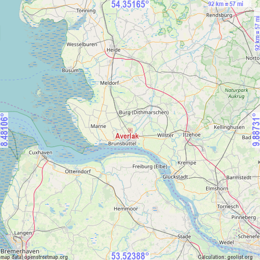
Averlak GPS coordinates[2]
53° 56' 23.352" North, 9° 11' 3.048" East
| Map corner | latitude | longitude |
|---|---|---|
| Upper-left | 54.35165°, | 8.48106° |
| Center: | 53.93982°, | 9.18418° |
| Lower-right: | 53.52388°, | 9.88731° |
| Map W x H: | 92×92 km | = 57.2×57.2mi |
| max Lat: | 55.01917° ⇑8.2% North |
| Averlak: | 53.93982° |
| min Lat: | ⇓91.8% South 47.40724° |
| min Long | Averlak | max Long |
| 5.92978° | 9.18418° | 14.98853° |
| W 37.4%⇐ | ⇒62.6% E |
Elevation
Elevation of Averlak is 0 m = 0 ft, and this is 249.1 m = 817 ft below average elevation for this country.
| Max E: |
1256 m = 4121 ft | 99.1% |
| Avg. | 249.1 m = 817 ft | |
| Averlak | 0 m = 0 ft | |
Min E: |
-5 m = -16 ft | 0.9% |
See also: Germany elevation on elevation.city.
Geographical zone
Averlak is located in North temperate zone (between Tropic of Cancer and the Arctic Circle). Distance of this North polar circle is 1403.6 km =872.2 mi to North.| Distance of | km | miles | from Averlak |
|---|---|---|---|
| North Pole | 4009.5 | 2491.4 | to North |
| Arctic Circle | 1403.6 | 872.2 | to North |
| Tropic Cancer | 3391.6 | 2107.4 | to South |
| Equator | 5997.5 | 3726.7 | to South |


Nearby cities:
15 places around Averlak: (largest is in red/bold)
• Aebtissinwisch
7.1 km =4.4 mi,  65°
65°
• Brunsbüttel
7.2 km =4.5 mi,  226°
226°
• Buchholz
6 km =3.7 mi,  25°
25°
• Burg
8 km =5 mi,  37°
37°
• Büttel
5.5 km =3.4 mi,  143°
143°
• Dingen
5.3 km =3.3 mi,  304°
304°
• Ecklak
5.5 km =3.4 mi,  78°
78°
• Eddelak
2.5 km =1.6 mi, 296°
• Kuden
3 km =1.9 mi,  358°
358°
• Kudensee
2.2 km =1.4 mi,  108°
108°
• Landscheide
5 km =3.1 mi,  115°
115°
• Quickborn
8 km =5 mi,  11°
11°
• Ramhusen
6.7 km =4.2 mi,  279°
279°
• Sankt Margarethen
7 km =4.3 mi, 139°
• Sankt Michaelisdonn
6.6 km =4.1 mi,  317°
317°
Sources, notices
• [Note1] Compared only with cities in Germany existing in our database
• [Src1] Map data: © OpenStreetMap contributors (CC-BY-SA)
• [Src2] Other city data from geonames.org with taken over terms of usage.
• [Src3] Geographical zone / Annual Mean Temperature by Robert A. Rohde @ Wikipedia
