Buchenbach geodata
Buchenbach (Baden-Württemberg) is a seat of a fourth-order administrative division; located in Germany in Europe/Berlin (GMT+2) time zone. With population of 3,364 people, there are 3709 cities with bigger population in this country. Compared to other cities in Germany, 95.9% of cities are located further ↑North; 76.9% of cities are located further →East and 82.4% of cities have lower elevation than Buchenbach. Note1
Administrative division(s):
- Level 1: Baden-Württemberg
- Level 2: Freiburg Region
- Level 3: Landkreis Breisgau-Hochschwarzwald
- Level 4: Buchenbach


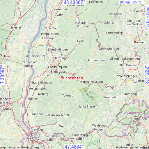
Buchenbach GPS coordinates[2]
47° 57' 40.968" North, 8° 0' 32.724" East
| Map corner | latitude | longitude |
|---|---|---|
| Upper-left | 48.43007°, | 7.30597° |
| Center: | 47.96138°, | 8.00909° |
| Lower-right: | 47.4884°, | 8.71222° |
| Map W x H: | 104.7×104.7 km | = 65.1×65.1mi |
| max Lat: | 55.01917° ⇑95.9% North |
| Buchenbach: | 47.96138° |
| min Lat: | ⇓4.1% South 47.40724° |
| min Long | Buchenbach | max Long |
| 5.92978° | 8.00909° | 14.98853° |
| W 23.1%⇐ | ⇒76.9% E |
Elevation
Elevation of Buchenbach is 449 m = 1473 ft, and this is 199.9 m = 656 ft above average elevation for this country.
| Max E: |
1256 m = 4121 ft | 17.6% |
| Buchenbach | 449 m 1473 ft | |
| Avg. | 249.1 m = 817 ft | |
Min E: |
-5 m = -16 ft | 82.4% |
See also: Germany elevation on elevation.city.
Geographical zone
Buchenbach is located in North temperate zone (between Tropic of Cancer and the Arctic Circle). Distance of this North polar circle is 2068.4 km =1285.2 mi to North.| Distance of | km | miles | from Buchenbach |
|---|---|---|---|
| North Pole | 4674.3 | 2904.5 | to North |
| Arctic Circle | 2068.4 | 1285.2 | to North |
| Tropic Cancer | 2726.9 | 1694.4 | to South |
| Equator | 5332.8 | 3313.6 | to South |


Nearby cities:
15 places around Buchenbach: (largest is in red/bold)
• Au
13.1 km =8.1 mi,  264°
264°
• Breitnau
6.3 km =3.9 mi,  119°
119°
• Freiburg
12.3 km =7.6 mi,  288°
288°
• Glottertal
10.5 km =6.5 mi,  341°
341°
• Gundelfingen
14 km =8.7 mi,  310°
310°
• Heuweiler
12.8 km =8 mi,  320°
320°
• Hinterzarten
9.8 km =6.1 mi,  131°
131°
• Horben
11.1 km =6.9 mi,  253°
253°
• Kirchzarten
4.4 km =2.7 mi,  277°
277°
• Merzhausen
13.1 km =8.1 mi,  272°
272°
• Oberried
5.4 km =3.4 mi,  234°
234°
• Sankt Märgen
8.1 km =5 mi,  50°
50°
• Sankt Peter
6.2 km =3.9 mi,  16°
16°
• St. Peter
6.4 km =4 mi, 15°
• Stegen
4 km =2.5 mi, 307°
Sources, notices
• [Note1] Compared only with cities in Germany existing in our database
• [Src1] Map data: © OpenStreetMap contributors (CC-BY-SA)
• [Src2] Other city data from geonames.org with taken over terms of usage.
• [Src3] Geographical zone / Annual Mean Temperature by Robert A. Rohde @ Wikipedia
