Sternberg geodata
Sternberg (Mecklenburg-Vorpommern) is a populated place; located in Germany in Europe/Berlin (GMT+2) time zone. With population of 4,863 people, there are 2877 cities with bigger population in this country. Compared to other cities in Germany, 88.8% of cities are located further ↓South; 79.2% of cities are located further ←West and 89.3% of cities have higher elevation than Sternberg. Note1
Administrative division(s):
- Level 1: Mecklenburg-Vorpommern
- Level 3: Ludwigslust-Parchim
- Level 4: Sternberg


Sternberg GPS coordinates[2]
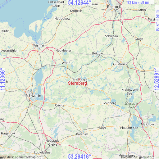
53° 42' 44.496" North, 11° 49' 36.408" East
| Map corner | latitude | longitude |
|---|---|---|
| Upper-left | 54.12644°, | 11.12366° |
| Center: | 53.71236°, | 11.82678° |
| Lower-right: | 53.29416°, | 12.52991° |
| Map W x H: | 92.5×92.5 km | = 57.5×57.5mi |
| max Lat: | 55.01917° ⇑11.2% North |
| Sternberg: | 53.71236° |
| min Lat: | ⇓88.8% South 47.40724° |
| min Long | Sternberg | max Long |
| 5.92978° | 11.82678° | 14.98853° |
| W 79.2%⇐ | ⇒20.8% E |
Elevation
Elevation of Sternberg is 23 m = 75 ft, and this is 226.1 m = 742 ft below average elevation for this country.
| Max E: |
1256 m = 4121 ft | 89.3% |
| Avg. | 249.1 m = 817 ft | |
| Sternberg | 23 m = 75 ft | |
Min E: |
-5 m = -16 ft | 10.7% |
See also: Germany elevation on elevation.city.
Geographical zone
Sternberg is located in North temperate zone (between Tropic of Cancer and the Arctic Circle). Distance of this North polar circle is 1428.9 km =887.9 mi to North.| Distance of | km | miles | from Sternberg |
|---|---|---|---|
| North Pole | 4034.8 | 2507.1 | to North |
| Arctic Circle | 1428.9 | 887.9 | to North |
| Tropic Cancer | 3366.3 | 2091.7 | to South |
| Equator | 5972.3 | 3711 | to South |


Nearby cities:
15 places around Sternberg: (largest is in red/bold)
• Borkow
9.7 km =6 mi,  123°
123°
• Brüel
7.9 km =4.9 mi,  290°
290°
• Dabel
7.5 km =4.7 mi,  139°
139°
• Demen
10 km =6.2 mi,  203°
203°
• Gägelow
5.5 km =3.4 mi, 123°
• Hohen Pritz
10.2 km =6.3 mi,  155°
155°
• Kuhlen
14.2 km =8.8 mi,  273°
273°
• Mestlin
16.1 km =10 mi, 155°
• Mustin
9.8 km =6.1 mi,  101°
101°
• Prüzen
14.4 km =8.9 mi,  70°
70°
• Rühn
14.2 km =8.8 mi,  31°
31°
• Tarnow
14.6 km =9.1 mi,  59°
59°
• Warin
12.6 km =7.8 mi,  320°
320°
• Warnow
8.9 km =5.5 mi,  23°
23°
• Witzin
6.3 km =3.9 mi,  79°
79°
Sources, notices
• [Note1] Compared only with cities in Germany existing in our database
• [Src1] Map data: © OpenStreetMap contributors (CC-BY-SA)
• [Src2] Other city data from geonames.org with taken over terms of usage.
• [Src3] Geographical zone / Annual Mean Temperature by Robert A. Rohde @ Wikipedia
