Borkow geodata
Borkow (Mecklenburg-Vorpommern) is a populated place; located in Germany in Europe/Berlin (GMT+2) time zone. With population of 548 people, there are 9089 cities with bigger population in this country. Compared to other cities in Germany, 88% of cities are located further ↓South; 81.1% of cities are located further ←West and 83.2% of cities have higher elevation than Borkow. Note1
Administrative division(s):
- Level 1: Mecklenburg-Vorpommern
- Level 3: Ludwigslust-Parchim
- Level 4: Borkow


Borkow GPS coordinates[2]
53° 39' 48.816" North, 11° 56' 58.884" East
| Map corner | latitude | longitude |
|---|---|---|
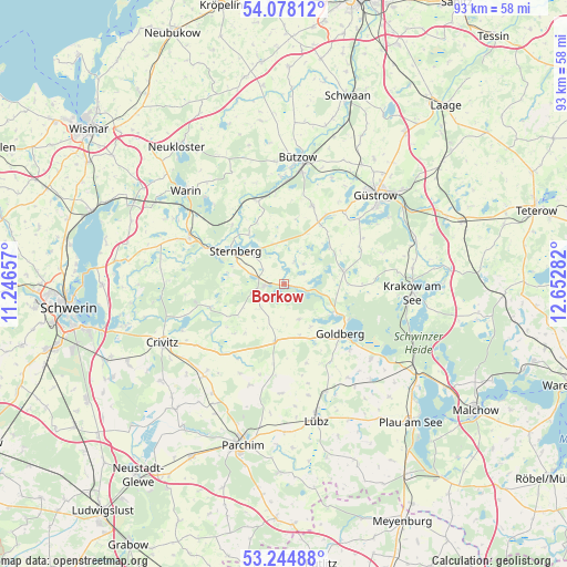
| Upper-left | 54.07812°, | 11.24657° |
| Center: | 53.66356°, | 11.94969° |
| Lower-right: | 53.24488°, | 12.65282° |
| Map W x H: | 92.6×92.6 km | = 57.5×57.5mi |
| max Lat: | 55.01917° ⇑12% North |
| Borkow: | 53.66356° |
| min Lat: | ⇓88% South 47.40724° |
| min Long | Borkow | max Long |
| 5.92978° | 11.94969° | 14.98853° |
| W 81.1%⇐ | ⇒18.9% E |
Elevation
Elevation of Borkow is 39 m = 128 ft, and this is 210.1 m = 689 ft below average elevation for this country.
| Max E: |
1256 m = 4121 ft | 83.2% |
| Avg. | 249.1 m = 817 ft | |
| Borkow | 39 m = 128 ft | |
Min E: |
-5 m = -16 ft | 16.8% |
See also: Germany elevation on elevation.city.
Geographical zone
Borkow is located in North temperate zone (between Tropic of Cancer and the Arctic Circle). Distance of this North polar circle is 1434.3 km =891.2 mi to North.| Distance of | km | miles | from Borkow |
|---|---|---|---|
| North Pole | 4040.2 | 2510.5 | to North |
| Arctic Circle | 1434.3 | 891.2 | to North |
| Tropic Cancer | 3360.9 | 2088.4 | to South |
| Equator | 5966.8 | 3707.6 | to South |


Nearby cities:
15 places around Borkow: (largest is in red/bold)
• Dabel
3.3 km =2.1 mi,  265°
265°
• Demen
12.7 km =7.9 mi,  252°
252°
• Dobbertin
9.4 km =5.8 mi,  118°
118°
• Goldberg
12.4 km =7.7 mi,  132°
132°
• Gägelow
4.3 km =2.7 mi,  304°
304°
• Hohen Pritz
5.4 km =3.4 mi,  225°
225°
• Lohmen
9.8 km =6.1 mi,  77°
77°
• Mestlin
9.4 km =5.8 mi,  189°
189°
• Mustin
3.8 km =2.4 mi,  23°
23°
• Prüzen
11.6 km =7.2 mi,  28°
28°
• Sternberg
9.7 km =6 mi, 303°
• Tarnow
13.6 km =8.5 mi, 19°
• Techentin
8.8 km =5.5 mi,  163°
163°
• Witzin
6.9 km =4.3 mi,  344°
344°
• Zehna
13.7 km =8.5 mi,  64°
64°
Sources, notices
• [Note1] Compared only with cities in Germany existing in our database
• [Src1] Map data: © OpenStreetMap contributors (CC-BY-SA)
• [Src2] Other city data from geonames.org with taken over terms of usage.
• [Src3] Geographical zone / Annual Mean Temperature by Robert A. Rohde @ Wikipedia
