Boms geodata
Boms (Baden-Württemberg) is a seat of a fourth-order administrative division; located in Germany in Europe/Berlin (GMT+2) time zone. With population of 597 people, there are 8849 cities with bigger population in this country. Compared to other cities in Germany, 95.8% of cities are located further ↑North; 57.6% of cities are located further →East and 95.7% of cities have lower elevation than Boms. Note1
Administrative division(s):
- Level 1: Baden-Württemberg
- Level 2: Tübingen Region
- Level 3: Landkreis Ravensburg
- Level 4: Boms


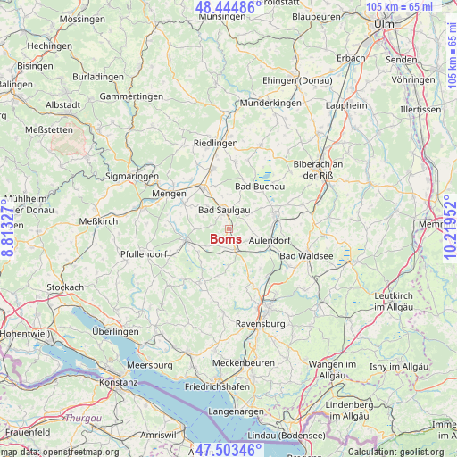
Boms GPS coordinates[2]
47° 58' 34.716" North, 9° 30' 59.004" East
| Map corner | latitude | longitude |
|---|---|---|
| Upper-left | 48.44486°, | 8.81327° |
| Center: | 47.97631°, | 9.51639° |
| Lower-right: | 47.50346°, | 10.21952° |
| Map W x H: | 104.7×104.7 km | = 65.1×65.1mi |
| max Lat: | 55.01917° ⇑95.8% North |
| Boms: | 47.97631° |
| min Lat: | ⇓4.2% South 47.40724° |
| min Long | Boms | max Long |
| 5.92978° | 9.51639° | 14.98853° |
| W 42.4%⇐ | ⇒57.6% E |
Elevation
Elevation of Boms is 615 m = 2018 ft, and this is 365.9 m = 1200 ft above average elevation for this country.
| Max E: |
1256 m = 4121 ft | 4.3% |
| Boms | 615 m 2018 ft | |
| Avg. | 249.1 m = 817 ft | |
Min E: |
-5 m = -16 ft | 95.7% |
See also: Germany elevation on elevation.city.
Geographical zone
Boms is located in North temperate zone (between Tropic of Cancer and the Arctic Circle). Distance of this North polar circle is 2066.7 km =1284.2 mi to North.| Distance of | km | miles | from Boms |
|---|---|---|---|
| North Pole | 4672.6 | 2903.4 | to North |
| Arctic Circle | 2066.7 | 1284.2 | to North |
| Tropic Cancer | 2728.5 | 1695.4 | to South |
| Equator | 5334.5 | 3314.7 | to South |


Nearby cities:
15 places around Boms: (largest is in red/bold)
• Allmannsweiler
8.2 km =5.1 mi,  44°
44°
• Altshausen
4.9 km =3 mi,  165°
165°
• Aulendorf
9.4 km =5.8 mi,  107°
107°
• Dürnau
9.8 km =6.1 mi,  17°
17°
• Ebenweiler
8.5 km =5.3 mi,  179°
179°
• Ebersbach-Musbach
5.1 km =3.2 mi,  102°
102°
• Eichstegen
4.9 km =3 mi,  194°
194°
• Fleischwangen
10.6 km =6.6 mi, 193°
• Guggenhausen
9.8 km =6.1 mi,  210°
210°
• Hoßkirch
5.7 km =3.5 mi,  239°
239°
• Königseggwald
8.8 km =5.5 mi, 237°
• Ostrach
10.3 km =6.4 mi,  253°
253°
• Riedhausen
9.9 km =6.2 mi,  221°
221°
• Saulgau
4.6 km =2.9 mi,  345°
345°
• Unterwaldhausen
9.3 km =5.8 mi,  203°
203°
Sources, notices
• [Note1] Compared only with cities in Germany existing in our database
• [Src1] Map data: © OpenStreetMap contributors (CC-BY-SA)
• [Src2] Other city data from geonames.org with taken over terms of usage.
• [Src3] Geographical zone / Annual Mean Temperature by Robert A. Rohde @ Wikipedia
