Saulgau geodata
Saulgau (Baden-Württemberg) is a populated place; located in Germany in Europe/Berlin (GMT+2) time zone. With population of 17,911 people, there are 884 cities with bigger population in this country. Compared to other cities in Germany, 95.3% of cities are located further ↑North; 57.7% of cities are located further →East and 94.6% of cities have lower elevation than Saulgau. Note1
Administrative division(s):
- Level 1: Baden-Württemberg
- Level 2: Tübingen Region
- Level 3: Landkreis Sigmaringen
- Level 4: Bad Saulgau


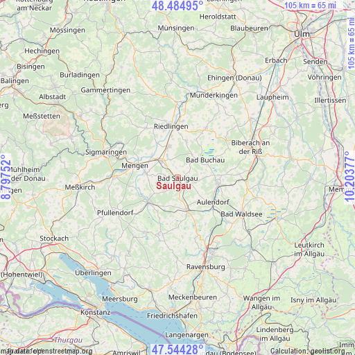
Saulgau GPS coordinates[2]
48° 1' 0.336" North, 9° 30' 2.304" East
| Map corner | latitude | longitude |
|---|---|---|
| Upper-left | 48.48495°, | 8.79752° |
| Center: | 48.01676°, | 9.50064° |
| Lower-right: | 47.54428°, | 10.20377° |
| Map W x H: | 104.6×104.6 km | = 65×65mi |
| max Lat: | 55.01917° ⇑95.3% North |
| Saulgau: | 48.01676° |
| min Lat: | ⇓4.7% South 47.40724° |
| min Long | Saulgau | max Long |
| 5.92978° | 9.50064° | 14.98853° |
| W 42.3%⇐ | ⇒57.7% E |
Elevation
Elevation of Saulgau is 590 m = 1936 ft, and this is 340.9 m = 1118 ft above average elevation for this country.
| Max E: |
1256 m = 4121 ft | 5.4% |
| Saulgau | 590 m 1936 ft | |
| Avg. | 249.1 m = 817 ft | |
Min E: |
-5 m = -16 ft | 94.6% |
See also: Germany elevation on elevation.city.
Geographical zone
Saulgau is located in North temperate zone (between Tropic of Cancer and the Arctic Circle). Distance of this North polar circle is 2062.2 km =1281.4 mi to North.| Distance of | km | miles | from Saulgau |
|---|---|---|---|
| North Pole | 4668.1 | 2900.6 | to North |
| Arctic Circle | 2062.2 | 1281.4 | to North |
| Tropic Cancer | 2733 | 1698.2 | to South |
| Equator | 5339 | 3317.5 | to South |


Nearby cities:
15 places around Saulgau: (largest is in red/bold)
• Allmannsweiler
7 km =4.3 mi,  79°
79°
• Altshausen
9.6 km =6 mi,  165°
165°
• Bad Buchau
9.7 km =6 mi,  58°
58°
• Boms
4.6 km =2.9 mi, 165°
• Dürmentingen
11.4 km =7.1 mi,  12°
12°
• Dürnau
6.3 km =3.9 mi,  40°
40°
• Ebersbach-Musbach
8.3 km =5.2 mi,  132°
132°
• Eichstegen
9.3 km =5.8 mi,  180°
180°
• Ertingen
9.6 km =6 mi,  344°
344°
• Herbertingen
7.5 km =4.7 mi,  317°
317°
• Hohentengen
9.3 km =5.8 mi,  278°
278°
• Hoßkirch
8.3 km =5.2 mi,  206°
206°
• Kanzach
8.1 km =5 mi,  32°
32°
• Königseggwald
11.2 km =7 mi, 213°
• Ostrach
11.5 km =7.1 mi,  229°
229°
Sources, notices
• [Note1] Compared only with cities in Germany existing in our database
• [Src1] Map data: © OpenStreetMap contributors (CC-BY-SA)
• [Src2] Other city data from geonames.org with taken over terms of usage.
• [Src3] Geographical zone / Annual Mean Temperature by Robert A. Rohde @ Wikipedia
