Schwarzach geodata
Schwarzach (Bavaria) is a populated place; located in Germany in Europe/Berlin (GMT+2) time zone. With population of 2,898 people, there are 4095 cities with bigger population in this country. Compared to other cities in Germany, 83.9% of cities are located further ↑North; 90.8% of cities are located further ←West and 71% of cities have lower elevation than Schwarzach. Note1
Administrative division(s):
- Level 1: Bavaria
- Level 2: Lower Bavaria
- Level 3: Landkreis Straubing-Bogen
- Level 4: Schwarzach, Markt


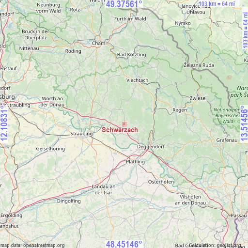
Schwarzach GPS coordinates[2]
48° 54' 56.412" North, 12° 48' 41.148" East
| Map corner | latitude | longitude |
|---|---|---|
| Upper-left | 49.37561°, | 12.10831° |
| Center: | 48.91567°, | 12.81143° |
| Lower-right: | 48.45146°, | 13.51456° |
| Map W x H: | 102.8×102.8 km | = 63.9×63.9mi |
| max Lat: | 55.01917° ⇑83.9% North |
| Schwarzach: | 48.91567° |
| min Lat: | ⇓16.1% South 47.40724° |
| min Long | Schwarzach | max Long |
| 5.92978° | 12.81143° | 14.98853° |
| W 90.8%⇐ | ⇒9.2% E |
Elevation
Elevation of Schwarzach is 366 m = 1201 ft, and this is 116.9 m = 384 ft above average elevation for this country.
| Max E: |
1256 m = 4121 ft | 29% |
| Schwarzach | 366 m 1201 ft | |
| Avg. | 249.1 m = 817 ft | |
Min E: |
-5 m = -16 ft | 71% |
See also: Germany elevation on elevation.city.
Geographical zone
Schwarzach is located in North temperate zone (between Tropic of Cancer and the Arctic Circle). Distance of this North polar circle is 1962.3 km =1219.3 mi to North.| Distance of | km | miles | from Schwarzach |
|---|---|---|---|
| North Pole | 4568.1 | 2838.5 | to North |
| Arctic Circle | 1962.3 | 1219.3 | to North |
| Tropic Cancer | 2833 | 1760.3 | to South |
| Equator | 5438.9 | 3379.6 | to South |


Nearby cities:
15 places around Schwarzach: (largest is in red/bold)
• Achslach
11 km =6.8 mi,  55°
55°
• Bernried
5.3 km =3.3 mi,  88°
88°
• Bogen
8.9 km =5.5 mi,  266°
266°
• Böbrach
5.6 km =3.5 mi,  69°
69°
• Hunderdorf
6.9 km =4.3 mi,  303°
303°
• Hunderdorf
10.4 km =6.5 mi,  255°
255°
• Irlbach
9.4 km =5.8 mi,  207°
207°
• Mariaposching
9.2 km =5.7 mi,  185°
185°
• Metten
10.2 km =6.3 mi,  131°
131°
• Neukirchen
7.8 km =4.8 mi,  328°
328°
• Niederwinkling
3.7 km =2.3 mi, 193°
• Offenberg
7.1 km =4.4 mi,  147°
147°
• Perasdorf
3.9 km =2.4 mi,  347°
347°
• Sankt Englmar
9.8 km =6.1 mi,  6°
6°
• Windberg
5.6 km =3.5 mi, 302°
Sources, notices
• [Note1] Compared only with cities in Germany existing in our database
• [Src1] Map data: © OpenStreetMap contributors (CC-BY-SA)
• [Src2] Other city data from geonames.org with taken over terms of usage.
• [Src3] Geographical zone / Annual Mean Temperature by Robert A. Rohde @ Wikipedia
