Bobitz geodata
Bobitz (Mecklenburg-Vorpommern) is a populated place; located in Germany in Europe/Berlin (GMT+2) time zone. With population of 1,274 people, there are 6381 cities with bigger population in this country. Compared to other cities in Germany, 90.1% of cities are located further ↓South; 72.1% of cities are located further ←West and 75.8% of cities have higher elevation than Bobitz. Note1
Administrative division(s):
- Level 1: Mecklenburg-Vorpommern
- Level 3: Nordwestmecklenburg
- Level 4: Bobitz


Bobitz GPS coordinates[2]
53° 48' 16.2" North, 11° 21' 32.904" East
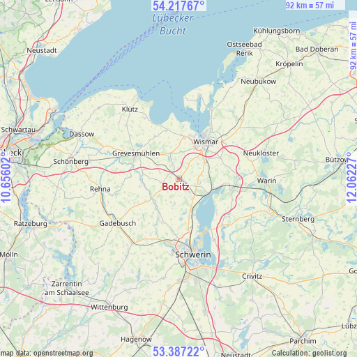
| Map corner | latitude | longitude |
|---|---|---|
| Upper-left | 54.21767°, | 10.65602° |
| Center: | 53.8045°, | 11.35914° |
| Lower-right: | 53.38722°, | 12.06227° |
| Map W x H: | 92.3×92.3 km | = 57.4×57.4mi |
| max Lat: | 55.01917° ⇑9.9% North |
| Bobitz: | 53.8045° |
| min Lat: | ⇓90.1% South 47.40724° |
| min Long | Bobitz | max Long |
| 5.92978° | 11.35914° | 14.98853° |
| W 72.1%⇐ | ⇒27.9% E |
Elevation
Elevation of Bobitz is 60 m = 197 ft, and this is 189.1 m = 620 ft below average elevation for this country.
| Max E: |
1256 m = 4121 ft | 75.8% |
| Avg. | 249.1 m = 817 ft | |
| Bobitz | 60 m = 197 ft | |
Min E: |
-5 m = -16 ft | 24.2% |
See also: Germany elevation on elevation.city.
Geographical zone
Bobitz is located in North temperate zone (between Tropic of Cancer and the Arctic Circle). Distance of this North polar circle is 1418.7 km =881.5 mi to North.| Distance of | km | miles | from Bobitz |
|---|---|---|---|
| North Pole | 4024.6 | 2500.8 | to North |
| Arctic Circle | 1418.7 | 881.5 | to North |
| Tropic Cancer | 3376.6 | 2098.1 | to South |
| Equator | 5982.5 | 3717.4 | to South |


Nearby cities:
15 places around Bobitz: (largest is in red/bold)
• Alt Meteln
6.5 km =4 mi,  190°
190°
• Bad Kleinen
8.3 km =5.2 mi,  116°
116°
• Barnekow
7 km =4.3 mi,  7°
7°
• Beidendorf
3.2 km =2 mi,  35°
35°
• Groß Krankow
1.9 km =1.2 mi,  307°
307°
• Groß Stieten
6 km =3.7 mi,  80°
80°
• Hohen Viecheln
10.2 km =6.3 mi,  102°
102°
• Lübstorf
9.5 km =5.9 mi,  157°
157°
• Mecklenburg
8 km =5 mi,  58°
58°
• Mühlen Eichsen
8.9 km =5.5 mi,  234°
234°
• Plüschow
6.9 km =4.3 mi,  300°
300°
• Rüting
9.1 km =5.7 mi,  262°
262°
• Testorf-Steinfort
6.6 km =4.1 mi,  242°
242°
• Upahl
9.6 km =6 mi,  280°
280°
• Zickhusen
6.2 km =3.9 mi,  144°
144°
Sources, notices
• [Note1] Compared only with cities in Germany existing in our database
• [Src1] Map data: © OpenStreetMap contributors (CC-BY-SA)
• [Src2] Other city data from geonames.org with taken over terms of usage.
• [Src3] Geographical zone / Annual Mean Temperature by Robert A. Rohde @ Wikipedia
