Rüting geodata
Rüting (Mecklenburg-Vorpommern) is a populated place; located in Germany in Europe/Berlin (GMT+2) time zone. With population of 604 people, there are 8791 cities with bigger population in this country. Compared to other cities in Germany, 90% of cities are located further ↓South; 70.3% of cities are located further ←West and 84.5% of cities have higher elevation than Rüting. Note1
Administrative division(s):
- Level 1: Mecklenburg-Vorpommern
- Level 3: Nordwestmecklenburg
- Level 4: Rüting


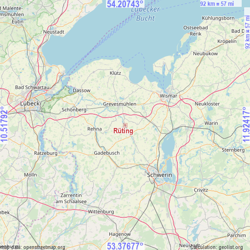
Rüting GPS coordinates[2]
53° 47' 38.976" North, 11° 13' 15.744" East
| Map corner | latitude | longitude |
|---|---|---|
| Upper-left | 54.20743°, | 10.51792° |
| Center: | 53.79416°, | 11.22104° |
| Lower-right: | 53.37677°, | 11.92417° |
| Map W x H: | 92.4×92.4 km | = 57.4×57.4mi |
| max Lat: | 55.01917° ⇑10% North |
| Rüting: | 53.79416° |
| min Lat: | ⇓90% South 47.40724° |
| min Long | Rüting | max Long |
| 5.92978° | 11.22104° | 14.98853° |
| W 70.3%⇐ | ⇒29.7% E |
Elevation
Elevation of Rüting is 36 m = 118 ft, and this is 213.1 m = 699 ft below average elevation for this country.
| Max E: |
1256 m = 4121 ft | 84.5% |
| Avg. | 249.1 m = 817 ft | |
| Rüting | 36 m = 118 ft | |
Min E: |
-5 m = -16 ft | 15.5% |
See also: Germany elevation on elevation.city.
Geographical zone
Rüting is located in North temperate zone (between Tropic of Cancer and the Arctic Circle). Distance of this North polar circle is 1419.8 km =882.2 mi to North.| Distance of | km | miles | from Rüting |
|---|---|---|---|
| North Pole | 4025.7 | 2501.5 | to North |
| Arctic Circle | 1419.8 | 882.2 | to North |
| Tropic Cancer | 3375.4 | 2097.4 | to South |
| Equator | 5981.3 | 3716.6 | to South |


Nearby cities:
15 places around Rüting: (largest is in red/bold)
• Alt Meteln
9.4 km =5.8 mi,  123°
123°
• Beidendorf
11.6 km =7.2 mi,  71°
71°
• Bobitz
9.1 km =5.7 mi,  82°
82°
• Börzow
9.6 km =6 mi,  319°
319°
• Cramonshagen
10.5 km =6.5 mi,  160°
160°
• Dragun
9.6 km =6 mi,  178°
178°
• Gadebusch
12.4 km =7.7 mi,  213°
213°
• Grevesmühlen
7.9 km =4.9 mi,  345°
345°
• Groß Krankow
7.9 km =4.9 mi, 72°
• Mühlen Eichsen
4.5 km =2.8 mi,  154°
154°
• Plüschow
5.6 km =3.5 mi,  34°
34°
• Rehna
11.4 km =7.1 mi,  261°
261°
• Testorf-Steinfort
3.7 km =2.3 mi, 121°
• Upahl
2.9 km =1.8 mi, 353°
• Veelböken
5.6 km =3.5 mi, 206°
Sources, notices
• [Note1] Compared only with cities in Germany existing in our database
• [Src1] Map data: © OpenStreetMap contributors (CC-BY-SA)
• [Src2] Other city data from geonames.org with taken over terms of usage.
• [Src3] Geographical zone / Annual Mean Temperature by Robert A. Rohde @ Wikipedia
