Bischberg geodata
Bischberg (Bavaria) is a seat of a fourth-order administrative division; located in Germany in Europe/Berlin (GMT+2) time zone. With population of 5,819 people, there are 2522 cities with bigger population in this country. Compared to other cities in Germany, 66.2% of cities are located further ↑North; 64.5% of cities are located further ←West and 52.2% of cities have lower elevation than Bischberg. Note1
Administrative division(s):
- Level 1: Bavaria
- Level 2: Upper Franconia
- Level 3: Landkreis Bamberg
- Level 4: Bischberg


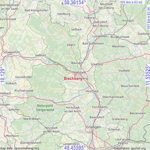
Bischberg GPS coordinates[2]
49° 54' 39.132" North, 10° 49' 55.632" East
| Map corner | latitude | longitude |
|---|---|---|
| Upper-left | 50.36154°, | 10.129° |
| Center: | 49.91087°, | 10.83212° |
| Lower-right: | 49.45595°, | 11.53525° |
| Map W x H: | 100.7×100.7 km | = 62.6×62.6mi |
| max Lat: | 55.01917° ⇑66.2% North |
| Bischberg: | 49.91087° |
| min Lat: | ⇓33.8% South 47.40724° |
| min Long | Bischberg | max Long |
| 5.92978° | 10.83212° | 14.98853° |
| W 64.5%⇐ | ⇒35.5% E |
Elevation
Elevation of Bischberg is 241 m = 791 ft, and this is 8.1 m = 27 ft below average elevation for this country.
| Max E: |
1256 m = 4121 ft | 47.8% |
| Avg. | 249.1 m = 817 ft | |
| Bischberg | 241 m = 791 ft | |
Min E: |
-5 m = -16 ft | 52.2% |
See also: Germany elevation on elevation.city.
Geographical zone
Bischberg is located in North temperate zone (between Tropic of Cancer and the Arctic Circle). Distance of this North polar circle is 1851.6 km =1150.5 mi to North.| Distance of | km | miles | from Bischberg |
|---|---|---|---|
| North Pole | 4457.5 | 2769.8 | to North |
| Arctic Circle | 1851.6 | 1150.5 | to North |
| Tropic Cancer | 2943.6 | 1829.1 | to South |
| Equator | 5549.6 | 3448.4 | to South |


Nearby cities:
15 places around Bischberg: (largest is in red/bold)
• Bamberg
5.1 km =3.2 mi,  105°
105°
• Baunach
8.5 km =5.3 mi,  9°
9°
• Breitengüßbach
7.8 km =4.8 mi,  29°
29°
• Frensdorf
10.8 km =6.7 mi,  166°
166°
• Gundelsheim
6.9 km =4.3 mi,  65°
65°
• Hallstadt
3.7 km =2.3 mi,  56°
56°
• Kemmern
5.9 km =3.7 mi, 33°
• Lauter
7.6 km =4.7 mi,  335°
335°
• Memmelsdorf
9.3 km =5.8 mi,  76°
76°
• Oberhaid
2.7 km =1.7 mi,  332°
332°
• Priesendorf
8.6 km =5.3 mi,  267°
267°
• Stegaurach
5.1 km =3.2 mi, 170°
• Stettfeld
10.3 km =6.4 mi,  310°
310°
• Viereth-Trunstadt
4.1 km =2.5 mi,  287°
287°
• Walsdorf
6 km =3.7 mi,  215°
215°
Sources, notices
• [Note1] Compared only with cities in Germany existing in our database
• [Src1] Map data: © OpenStreetMap contributors (CC-BY-SA)
• [Src2] Other city data from geonames.org with taken over terms of usage.
• [Src3] Geographical zone / Annual Mean Temperature by Robert A. Rohde @ Wikipedia
