Gundelsheim geodata
Gundelsheim (Bavaria) is a seat of a fourth-order administrative division; located in Germany in Europe/Berlin (GMT+2) time zone. With population of 3,292 people, there are 3757 cities with bigger population in this country. Compared to other cities in Germany, 65.4% of cities are located further ↑North; 65.8% of cities are located further ←West and 53.6% of cities have lower elevation than Gundelsheim. Note1
Administrative division(s):
- Level 1: Bavaria
- Level 2: Upper Franconia
- Level 3: Landkreis Bamberg
- Level 4: Gundelsheim


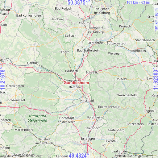
Gundelsheim GPS coordinates[2]
49° 56' 13.488" North, 10° 55' 11.64" East
| Map corner | latitude | longitude |
|---|---|---|
| Upper-left | 50.38751°, | 10.21678° |
| Center: | 49.93708°, | 10.9199° |
| Lower-right: | 49.4824°, | 11.62303° |
| Map W x H: | 100.6×100.6 km | = 62.5×62.5mi |
| max Lat: | 55.01917° ⇑65.4% North |
| Gundelsheim: | 49.93708° |
| min Lat: | ⇓34.6% South 47.40724° |
| min Long | Gundelsheim | max Long |
| 5.92978° | 10.9199° | 14.98853° |
| W 65.8%⇐ | ⇒34.2% E |
Elevation
Elevation of Gundelsheim is 250 m = 820 ft, and this is 0.90000000000001 m = 3 ft above average elevation for this country.
| Max E: |
1256 m = 4121 ft | 46.4% |
| Gundelsheim | 250 m 820 ft | |
| Avg. | 249.1 m = 817 ft | |
Min E: |
-5 m = -16 ft | 53.6% |
See also: Germany elevation on elevation.city.
Geographical zone
Gundelsheim is located in North temperate zone (between Tropic of Cancer and the Arctic Circle). Distance of this North polar circle is 1848.7 km =1148.7 mi to North.| Distance of | km | miles | from Gundelsheim |
|---|---|---|---|
| North Pole | 4454.6 | 2768 | to North |
| Arctic Circle | 1848.7 | 1148.7 | to North |
| Tropic Cancer | 2946.6 | 1830.9 | to South |
| Equator | 5552.5 | 3450.2 | to South |


Nearby cities:
15 places around Gundelsheim: (largest is in red/bold)
• Bamberg
4.5 km =2.8 mi,  197°
197°
• Baunach
7.3 km =4.5 mi,  318°
318°
• Bischberg
6.9 km =4.3 mi,  245°
245°
• Breitengüßbach
4.6 km =2.9 mi,  328°
328°
• Hallstadt
3.3 km =2.1 mi, 254°
• Kemmern
3.6 km =2.2 mi,  303°
303°
• Lauter
10.2 km =6.3 mi,  293°
293°
• Litzendorf
6.9 km =4.3 mi,  111°
111°
• Memmelsdorf
2.9 km =1.8 mi, 105°
• Oberhaid
7.5 km =4.7 mi,  266°
266°
• Rattelsdorf
9 km =5.6 mi,  345°
345°
• Scheßlitz
9.2 km =5.7 mi,  62°
62°
• Stegaurach
9.7 km =6 mi,  214°
214°
• Viereth-Trunstadt
10.3 km =6.4 mi,  260°
260°
• Zapfendorf
9 km =5.6 mi,  5°
5°
Sources, notices
• [Note1] Compared only with cities in Germany existing in our database
• [Src1] Map data: © OpenStreetMap contributors (CC-BY-SA)
• [Src2] Other city data from geonames.org with taken over terms of usage.
• [Src3] Geographical zone / Annual Mean Temperature by Robert A. Rohde @ Wikipedia
