Kemmern geodata
Kemmern (Bavaria) is a seat of a fourth-order administrative division; located in Germany in Europe/Berlin (GMT+2) time zone. With population of 2,639 people, there are 4296 cities with bigger population in this country. Compared to other cities in Germany, 64.9% of cities are located further ↑North; 65.1% of cities are located further ←West and 51.9% of cities have lower elevation than Kemmern. Note1
Administrative division(s):
- Level 1: Bavaria
- Level 2: Upper Franconia
- Level 3: Landkreis Bamberg
- Level 4: Kemmern


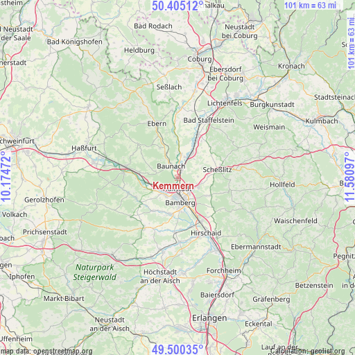
Kemmern GPS coordinates[2]
49° 57' 17.496" North, 10° 52' 40.224" East
| Map corner | latitude | longitude |
|---|---|---|
| Upper-left | 50.40512°, | 10.17472° |
| Center: | 49.95486°, | 10.87784° |
| Lower-right: | 49.50035°, | 11.58097° |
| Map W x H: | 100.6×100.6 km | = 62.5×62.5mi |
| max Lat: | 55.01917° ⇑64.9% North |
| Kemmern: | 49.95486° |
| min Lat: | ⇓35.1% South 47.40724° |
| min Long | Kemmern | max Long |
| 5.92978° | 10.87784° | 14.98853° |
| W 65.1%⇐ | ⇒34.9% E |
Elevation
Elevation of Kemmern is 239 m = 784 ft, and this is 10.1 m = 33 ft below average elevation for this country.
| Max E: |
1256 m = 4121 ft | 48.1% |
| Avg. | 249.1 m = 817 ft | |
| Kemmern | 239 m = 784 ft | |
Min E: |
-5 m = -16 ft | 51.9% |
See also: Germany elevation on elevation.city.
Geographical zone
Kemmern is located in North temperate zone (between Tropic of Cancer and the Arctic Circle). Distance of this North polar circle is 1846.7 km =1147.5 mi to North.| Distance of | km | miles | from Kemmern |
|---|---|---|---|
| North Pole | 4452.6 | 2766.7 | to North |
| Arctic Circle | 1846.7 | 1147.5 | to North |
| Tropic Cancer | 2948.5 | 1832.1 | to South |
| Equator | 5554.5 | 3451.4 | to South |


Nearby cities:
15 places around Kemmern: (largest is in red/bold)
• Bamberg
6.5 km =4 mi,  165°
165°
• Baunach
3.9 km =2.4 mi,  331°
331°
• Bischberg
5.9 km =3.7 mi,  213°
213°
• Breitengüßbach
2 km =1.2 mi,  16°
16°
• Gerach
10.3 km =6.4 mi, 327°
• Gundelsheim
3.6 km =2.2 mi,  123°
123°
• Hallstadt
2.9 km =1.8 mi,  183°
183°
• Lauter
6.7 km =4.2 mi,  287°
287°
• Memmelsdorf
6.4 km =4 mi, 115°
• Oberhaid
5.2 km =3.2 mi,  241°
241°
• Rattelsdorf
6.7 km =4.2 mi,  6°
6°
• Reckendorf
7.6 km =4.7 mi,  335°
335°
• Stegaurach
10.2 km =6.3 mi,  193°
193°
• Viereth-Trunstadt
8.1 km =5 mi, 243°
• Zapfendorf
8 km =5 mi,  29°
29°
Sources, notices
• [Note1] Compared only with cities in Germany existing in our database
• [Src1] Map data: © OpenStreetMap contributors (CC-BY-SA)
• [Src2] Other city data from geonames.org with taken over terms of usage.
• [Src3] Geographical zone / Annual Mean Temperature by Robert A. Rohde @ Wikipedia
