Bechstedt geodata
Bechstedt (Thuringia) is a seat of a fourth-order administrative division; located in Germany in Europe/Berlin (GMT+2) time zone. With population of 182 people, there are 10552 cities with bigger population in this country. Compared to other cities in Germany, 51.1% of cities are located further ↓South; 69.4% of cities are located further ←West and 68.6% of cities have lower elevation than Bechstedt. Note1


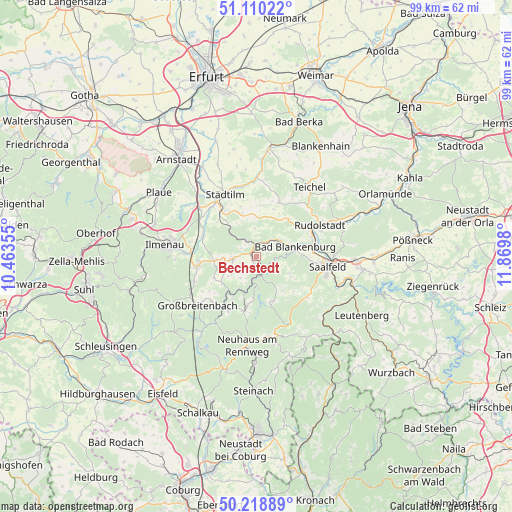
Bechstedt GPS coordinates[2]
50° 40' 0.012" North, 11° 10' 0.012" East
| Map corner | latitude | longitude |
|---|---|---|
| Upper-left | 51.11022°, | 10.46355° |
| Center: | 50.66667°, | 11.16667° |
| Lower-right: | 50.21889°, | 11.8698° |
| Map W x H: | 99.1×99.1 km | = 61.6×61.6mi |
| max Lat: | 55.01917° ⇑48.9% North |
| Bechstedt: | 50.66667° |
| min Lat: | ⇓51.1% South 47.40724° |
| min Long | Bechstedt | max Long |
| 5.92978° | 11.16667° | 14.98853° |
| W 69.4%⇐ | ⇒30.6% E |
Elevation
Elevation of Bechstedt is 347 m = 1138 ft, and this is 97.9 m = 321 ft above average elevation for this country.
| Max E: |
1256 m = 4121 ft | 31.4% |
| Bechstedt | 347 m 1138 ft | |
| Avg. | 249.1 m = 817 ft | |
Min E: |
-5 m = -16 ft | 68.6% |
See also: Germany elevation on elevation.city.
Geographical zone
Bechstedt is located in North temperate zone (between Tropic of Cancer and the Arctic Circle). Distance of this North polar circle is 1767.6 km =1098.3 mi to North.| Distance of | km | miles | from Bechstedt |
|---|---|---|---|
| North Pole | 4373.5 | 2717.6 | to North |
| Arctic Circle | 1767.6 | 1098.3 | to North |
| Tropic Cancer | 3027.7 | 1881.3 | to South |
| Equator | 5633.6 | 3500.6 | to South |


Nearby cities:
15 places around Bechstedt: (largest is in red/bold)
• Allendorf
1.5 km =0.9 mi,  204°
204°
• Bad Blankenburg
7.7 km =4.8 mi,  77°
77°
• Dröbischau
7.8 km =4.8 mi,  238°
238°
• Döschnitz
7.3 km =4.5 mi,  139°
139°
• Herschdorf
9.3 km =5.8 mi, 243°
• Königsee
4.9 km =3 mi,  263°
263°
• Mellenbach-Glasbach
7.3 km =4.5 mi,  220°
220°
• Oberhain
4.4 km =2.7 mi,  212°
212°
• Pennewitz
8 km =5 mi, 264°
• Rohrbach
8.2 km =5.1 mi,  154°
154°
• Rottenbach
2.4 km =1.5 mi,  0°
0°
• Schwarzburg
3.2 km =2 mi, 145°
• Sitzendorf
3.9 km =2.4 mi,  174°
174°
• Unterweißbach
5.9 km =3.7 mi,  179°
179°
• Wittgendorf
8.8 km =5.5 mi, 147°
Sources, notices
• [Note1] Compared only with cities in Germany existing in our database
• [Src1] Map data: © OpenStreetMap contributors (CC-BY-SA)
• [Src2] Other city data from geonames.org with taken over terms of usage.
• [Src3] Geographical zone / Annual Mean Temperature by Robert A. Rohde @ Wikipedia
